
Where the sky keeps bursting
McDOWELL COUNTY, W.Va. — Carol Lester remembers every flood.The epic one in 1977, when she fled over a mountain with her young children to avoid rising water. The deluges of 2001 and 2002, which left a trail of destruction in this area but somehow spared the modest house she and her husband have shared for more than a half century.But like many others who have spent their lives in the coalfields of southern West Virginia, she had never seen the likes of what arrived on a frigid day this past February. Days of rain sent the Tug Fork River surging from a relatively calm 6.8 feet to a raging 22.7 feet in just 10 hours, filling the river and its tributaries far beyond their banks.“It was like you could hear the devil and his demons in that water,” recalled Lester, 73, who endured a harrowing escape thanks to friends who came to the couple’s rescue. “I’ve never been so scared in my life.”“The next flood that comes, there might not be any house.”— Carol LesterAcross McDowell County, the rising water wrecked roads and bridges and left residents stranded. It swallowed cars and trucks, sent debris downstream, flooded homes and claimed three lives, including that of a 2-year-old boy. In the town of Welch, the flood swamped city hall, the library and the sheriff’s station. It also blocked the main road to the hospital.This time, the devastation carried the fingerprints of a mostly invisible but profound atmospheric shift: As the air gets warmer and wetter over time, states within central Appalachia lie within a region particularly vulnerable to the extreme rainfall and the flooding that often follows.To understand how that increasing moisture in the skies has driven these downpours, The Washington Post examined a metric called integrated vapor transport (IVT) — which characterizes where plumes are flowing from and their intensity. Across much of the planet in recent decades, the analysis has found rising temperatures and shifting wind patterns have waterlogged the atmosphere, raising the odds for more destructive, torrential rainstorms that can cause floods.That is true in swaths of the eastern United States, as well as parts of California and other states in the Intermountain West, where atmospheric rivers rising from the Pacific Ocean are slamming into the region with increasing force.But some hot spots in the American West and Northeast are wealthier and have homes and businesses distributed over a wider area, which help make them less vulnerable to punishing storms.In central Appalachia, the changes high above are exacerbating devastation below in an area where mountainous terrain, widespread poverty and infrastructure built along snaking waterways makes preparing for floods difficult — and recovering from them that much tougher.The broader hot spot in the East is one of the longest ones in the world — stretching about 2,000 miles from Florida to Newfoundland, an expanse that is home to roughly 131 million people.Trends dating to 1992 show that central Appalachia sits in an area where this conveyor belt of moisture has increased at some of the highest rates anywhere in the nation. A Post analysis of 75 years of rain gauge data for central Appalachia shows that the area now experiences about two more days of heavy rainfall each year, a 35 percent increase compared to 1950.And in central Appalachia — in a swath where around 8 million people live in cities like Knoxville, Tennessee; Asheville, North Carolina; and Charleston, West Virginia — warming waters in the Gulf create plumes that repeatedly flow across the mountainous region. In West Virginia and Kentucky, for example, around 79 and 93 percent of land area respectively has seen moisture flows increase significantly, repeatedly driving heavy rain.Sometimes, heavy rains that hit these hot spots come as a relief, helping to break droughts. But more often, they arrive as the kind of deluges that can trigger damaging floods.Josh Gibson rides his bike in Welch. (Tom Brenner/For The Washington Post)Again and again in recent years, some of central Appalachia’s most devastating disasters have unfolded during periods when plumes of intensely moist air fueled catastrophic rainfall.Such moisture drove the storms in southern West Virginia earlier this year and those the year before. It helped to fuel 2022 floods in eastern Kentucky and April’s floods in northern and western Kentucky. A historic storm battered much of West Virginia in 2016, when as much as 7 inches of rain fell over a period of 24 hours, with flash floods killing at least 23 across the state.The region’s floods have claimed nearly 300 lives since 2000, on average about a dozen per year, a Post analysis of National Weather Service storm events data found.The trend shows no signs of slowing. As long as the planet keeps warming, the atmosphere’s capacity to hold water will increase — at about 4 percent per degree Fahrenheit.Chart showing heavy rain days in Central Appalachia“It’s going to continue to intensify and get worse, and it’s going to happen more frequently,” said Nicolas Zegre, director of the Mountain Hydrology Lab at West Virginia University, whose work is focused on trying to help communities in the region become more resilient to extreme weather events.“We are underprepared in so many ways.”But preparation is complicated, and not just because it’s hard to predict where the next flood will hit.So much of what humans have built in Appalachia is susceptible. That includes homes, businesses, railroad tracks and fire stations.According to the West Virginia Flood Resiliency Framework created by researchers at WVU, the state has more than 80,000 structures that lie in a zone deemed high-risk by the Federal Emergency Management Agency. Nearly 200,000 residents also live in these areas.And other factors, including waterways that have long been choked with debris, only exacerbate the rain’s impact.Flooding, Zegre and others are quick to note, is just one of the many challenges of life here and elsewhere in Appalachia. The area is among the poorest in the nation. It has endured the opioid epidemic, population loss and the decline of the coal industry.“Before the disaster even strikes, communities are already stressed,” Zegre said. “There’s food insecurity, there’s drinking water insecurity, there’s employment insecurity, there’s poor public health.”All that combined, he said, leaves many Appalachian communities “in a precarious place.”Children play in a pool on Summers Street in Welch. (Tom Brenner/The Washington Post)Many of the buildings in Welch lie in areas considered at high risk of flooding by the Federal Emergency Management Agency. (Tom Brenner/For The Washington Post)Linda Lou Woods stands outside her back door where a watermark is still visible from the February flooding. (Tom Brenner/For The Washington Post)Carol Lester is among the stressed, wondering what lies ahead.“This one, it wasn’t normal,” she said of the February storm one afternoon in the living room with donated furniture and the new floor her brother had installed to replace what got ruined. “The water came down so fast, and then it rose so fast. … There was water coming from places I’ve never seen water come from.”She and her husband, John, are back in their home. But even as she says how grateful she is for that, she gestures at the water line still visible on her front door, and the babbling brook out front.“The next flood that comes, there might not be any house.”‘Ground zero for flooding’So many floods have hit the region in recent years, they have become impossible to ignore.“It rains harder and more often than any time I can remember,” said Rodney Fouch, the city manager in Morehead, Kentucky, 60 miles east of Lexington. “We get closer [to flooding] a lot more often.”That was evident last year, when Hurricane Helene dumped biblical rains across five southern Appalachian states. Most deadly in western North Carolina, the floods that followed also killed residents, destroyed homes and wrecked roads in South Carolina, Tennessee, Virginia, Georgia and Florida.“If we can’t use the rainy day fund for a literal rainy day, why does it even exist? If we can’t use it for an actual emergency, then why do we have it?”— Rev. Brad DavisWhen the flooding hit southern West Virginia in February, the rains also sent rivers rising through Tennessee, Virginia and eastern Kentucky, where nearly two dozen people died. The storm brought reminders of Kentucky’s 2022 flood.“It happens so often now, you kind of forget the year and the time,” Fouch said.If there’s a bull’s eye to the Appalachian flooding hot spot, it’s the hollers where Kentucky meets West Virginia.Map key explaining the colors on the following map representing the share of properties in U.S. counties facing risk of extreme damage from floodingMap showing the share of homes at risk of extreme damage from flooding in U.S. counties. 29% of homes in McDowell County, West Virginia are at risk. Data on the map is from Cotality.Of the 16 U.S. counties that have experienced the most frequent federally declared flooding disasters since 2004, 11 of them are in Kentucky, according to a Post analysis of FEMA disaster declarations. In three of those Kentucky counties, there has been an average of one federally declared flooding disaster every year for the past two decades.Especially in eastern Kentucky, floodplains tend to be among the only places flat enough for towns to grow, said Brian Storz, the Licking River basin coordinator for the Kentucky Division of Water.“We’re kind of ground zero for flooding,” Storz said.There, and in other parts of Appalachia, that recognition is starting to spur more action.In the hardest-hit Kentucky counties, the U.S. Army Corps of Engineers launched a study this year of how to lower flood risks in the future, whether through infrastructure like dams or levees, or measures such as buyouts of at-risk buildings. The study process typically takes three years, but could take longer given that it covers such a large area, said Laura Mattingly, chief of the planning formulation division of the Army Corps’ Louisville district office.West Virginia will soon embark on two similar studies, its governor announced this summer, nearly a decade after the crippling 2016 floods that spurred calls for ways to protect vulnerable valley towns.A resident of Welch shovels out mud from a damaged downtown apartment building basement. (Tom Brenner/For The Washington Post)Officials have been working for years on a project that would guard the West Virginia town of Milton from floodwaters flowing out of the Mud River. And they have acknowledged the project’s rising importance, estimating that if it experienced what is considered a 100-year flood event, waters would inundate some 650 buildings.In east Tennessee, there are efforts to plant hundreds of trees across the barren stretches of packed soil where mines once stood, so that more rain is absorbed into the soil instead of flowing into the Cumberland River. It flows to Nashville, where there are also efforts to increase tree cover and remove pavement to reduce runoff, said Mekayle Houghton, executive director of the Cumberland River Compact.The hope is that, even if the efforts cannot stop the most disastrous flooding, they can limit the damage, Houghton said.In Kentucky, there are ongoing efforts to build entire new communities at higher ground — in some cases, atop former mines. Researchers also are working to develop improved warning systems to detect signs of floods earlier.Scientists have estimated that for every mile of any steadily flowing stream, there are about 10 miles of ephemeral streams that feed it, said Christopher Barton, a professor of forest hydrology and watershed management at the University of Kentucky.Such streams are shallow, narrow and usually dry gullies, and they quickly fill up in a downpour. When many of these small tributaries begin gushing into rivers at once, even the larger waterways can rise quickly and overflow their banks.When a torrent comes, Barton said, “It doesn’t take long to overwhelm those systems.”An abandoned house along the hillside overlooking downtown Welch and the Tug River. (Tom Brenner/For The Washington Post)In eastern Kentucky, some communities are mulling projects that could lower floodwaters by even a few inches. Storz is working with nearly two dozen towns and county governments on plans to widen and deepen floodplains to allow for water that perennially overflows from tributaries of the Licking River.Engineering estimates suggest that in Morehead, that effort could lower floodwaters by at least a few inches, Fouch said.“Two inches doesn’t sound like a lot, unless you’ve had 2 inches in your house before,” he said.You won’t find better people,” Howard Short, who has lived on Summers Street since the 1970s, said of his neighbors in Welch. (Tom Brenner/For The Washington Post)Clothing on a tree branch on Elkhorn Creek. (Tom Brenner/For The Washington Post)Work to explore the idea, which organizers have dubbed “green sinks,” is funded through FEMA grants that have been frozen by the Trump administration.For now, state and local officials are left hoping the agency will still be able to help the project move to the engineering and construction phase, or that some other source of funding will materialize.Trying to prevent ‘so many heartaches’On a Friday in early April, lawmakers in West Virginia’s capital paused for a moment of prayer for flood victims in the state.House Minority Leader Sean Hornbuckle (D-Cabell) soon rose. Prayers alone were not enough, he said. “We have the ability to do something earthly.”He had proposed to set aside $250 million — with half of it coming from the state’s $1.4 billion rainy day fund — to help communities in the state better prepare for floods. When that failed, he led an effort to earmark $50 million in the state budget to go toward flood mitigation projects. That proposal failed, too.“It’s just the worry of, is it going to happen again?”— Linda PearsonFor Hornbuckle, there is an economic argument to be made that the state could avoid costly flood damages on the back end with some up-front investment, as well as lessen unemployment and job loss. But also, he said, “It’s a moral issue. We have the obligation as a state to help our residents when they are in need.”But his efforts, like those before, so far have foundered. In 2023, with the backing of then-Gov. Jim Justice (R), lawmakers had created a Flood Resiliency Trust Fund intended to help struggling communities adapt and prepare for the flood risks.Years later, the trust has yet to be funded.Gov. Patrick Morrisey (R), whose office did not respond to requests for comment, has acknowledged more extreme rainfall will come. He said he wants to ensure the state is learning from each flood, using damage assessments and post-disaster reviews to guide preparations for the next catastrophe.But he also has stressed how difficult those preparations can be.“It’s pretty unbelievable,” he said during a June news conference after yet another deadly bout of flooding struck northern parts of the state, adding, “You could have large areas where there’s some rain but then in one concentrated area it’s a torrential downpour, and you’re seeing massive quantities of water dumped. It’s just Mother Nature at its worst. And so, it’s not something that’s easy to foresee.”Welch’s downtown, which sits at the confluence of the Tug Fork River and a creek, is particularly flood-prone. (Tom Brenner/For The Washington Post)Dried mud from the February flood seen through a downtown storefront window. (Tom Brenner/For The Washington Post)Shawn Rutherford talks about the floodwaters that tore through his home in February in Berwind. 'If it does it again, I'm done,' he said. 'I'm out of here.' (Tom Brenner/For The Washington Post)As lawmakers debated in the state capital and flooding plagued other parts of the state and region, recovery remained a struggle in McDowell County.Long after the February floods, piles of debris and ruined appliances sat stacked in yards and driveways. Many houses remained unlivable or in various states of disrepair. Some residents decided to forego planting gardens over the summer, fearful of what contaminated floodwaters had left behind.The looming threat of future floods only compounds the unease. In the small community of Berwind, Linda Pearson keeps jugs of bleach on her basement stairs as she tries to keep the mold at bay and continues to eye a nearby creek.A downed utility pole near Lester's residence on June 3, months after the floods. (Tom Brenner/For The Washington Post)She finds it hard to rest when it rains and stays awake watching the creek that not long ago swallowed part of her home. “I have a bag packed, and I keep it by our bed,” she said.The Rev. Brad Davis, who pastors five local United Methodist congregations, has been displaced ever since he fled the rising waters inside his Welch home on Lake Drive. It was built in 1950, but until this year had never flooded on the main living area. For now, he still lives in a spare apartment owned by one of his parishioners.“I’m not a scientist, but it seems to me as though the amount of rain being dumped is increasing in a much shorter time window,” said Davis, who grew up in nearby Mingo County.He has been an outspoken critic of the state’s lack of action, and has pushed lawmakers in Charleston to fund the state’s flood resiliency efforts.“We have got to do some things to help ourselves, because it’s going to happen again.”— Mayor Harold McBride“If we can’t use the rainy day fund for a literal rainy day, why does it even exist?” he said. “If we can’t use it for an actual emergency, then why do we have it?”Welch Mayor Harold McBride said he has written to state officials too, asking for more money to build flood walls and an overpass along an especially problematic road in town.At the same time, McBride said, people here take pride in their ability to carry on and persist without outside help. Even the mayor has spent the months since the February flood helping to rebuild parts of town himself — on a June day, he was part of a crew racing to restore the Coaltown Creamery, a city-run ice cream shop, ahead of a weekend festival in town.A young neighborhood resident points to an elevated, occupied home along the Riverside Drive hill in Welch. (Tom Brenner/For The Washington Post)Still, he is hopeful help will come — from the governor, from FEMA, from anywhere. But he also knows residents can’t wait around for support that might never arrive, that they must figure out how to better protect this place from the water that can change so much in a flash.“In the past, the only thing we do is shovel the mud and forget about it,” he said. “But we have got to do some things to help ourselves prepare, because it’s going to happen again.”About this storyStory editing by Paulina Firozi, Simon Ducroquet, Anu Narayanswamy and Katie Zezima. Additional editing by Juliet Eilperin. Photo editing by Dominique Hildebrand. Video editing by John Farrell. Copy editing by Gaby Morera Di Núbila.Design and development by Talia Trackim and Hailey Haymond. Design editing by Betty Chavarria.MethodologyTo examine trends in heavy rainfall The Post analyzed 75 years of rain gauge data from 28 stations in three central subregions of Appalachia produced by NOAA’s National Centers for Environmental Information. The area encompasses all of West Virginia and portions of Ohio, Kentucky, Virginia, North Carolina and Tennessee.To define what counts as a heavy rainfall day, The Post used the period from 1950 to 1989 as the base for determining the 95th percentile precipitation event at each station. Days with at least 0.5 millimeters of precipitation were included. Using a simple linear regression, The Post measured the change in frequency of the 95th percentile rain events at each station from 1950 to 2024.The analysis showed a significant positive trend in 95th percentile rain events in the central regions of Appalachia, where the number of days each year with heavy rainfall has increased by two, a 35 percent increase.To investigate global changes in extreme precipitation, The Post measured the amount of water vapor flowing through Earth’s atmosphere, a metric called integrated vapor transport (IVT). The analysis also identified days and locations where heavy rainfall coincided with high IVT. See more about The Post’s methodology for the IVT analysis here.
Read more
McDOWELL COUNTY, W.Va. — Carol Lester remembers every flood.
The epic one in 1977, when she fled over a mountain with her young children to avoid rising water. The deluges of 2001 and 2002, which left a trail of destruction in this area but somehow spared the modest house she and her husband have shared for more than a half century.
But like many others who have spent their lives in the coalfields of southern West Virginia, she had never seen the likes of what arrived on a frigid day this past February. Days of rain sent the Tug Fork River surging from a relatively calm 6.8 feet to a raging 22.7 feet in just 10 hours, filling the river and its tributaries far beyond their banks.
“It was like you could hear the devil and his demons in that water,” recalled Lester, 73, who endured a harrowing escape thanks to friends who came to the couple’s rescue. “I’ve never been so scared in my life.”
“The next flood that comes, there might not be any house.”
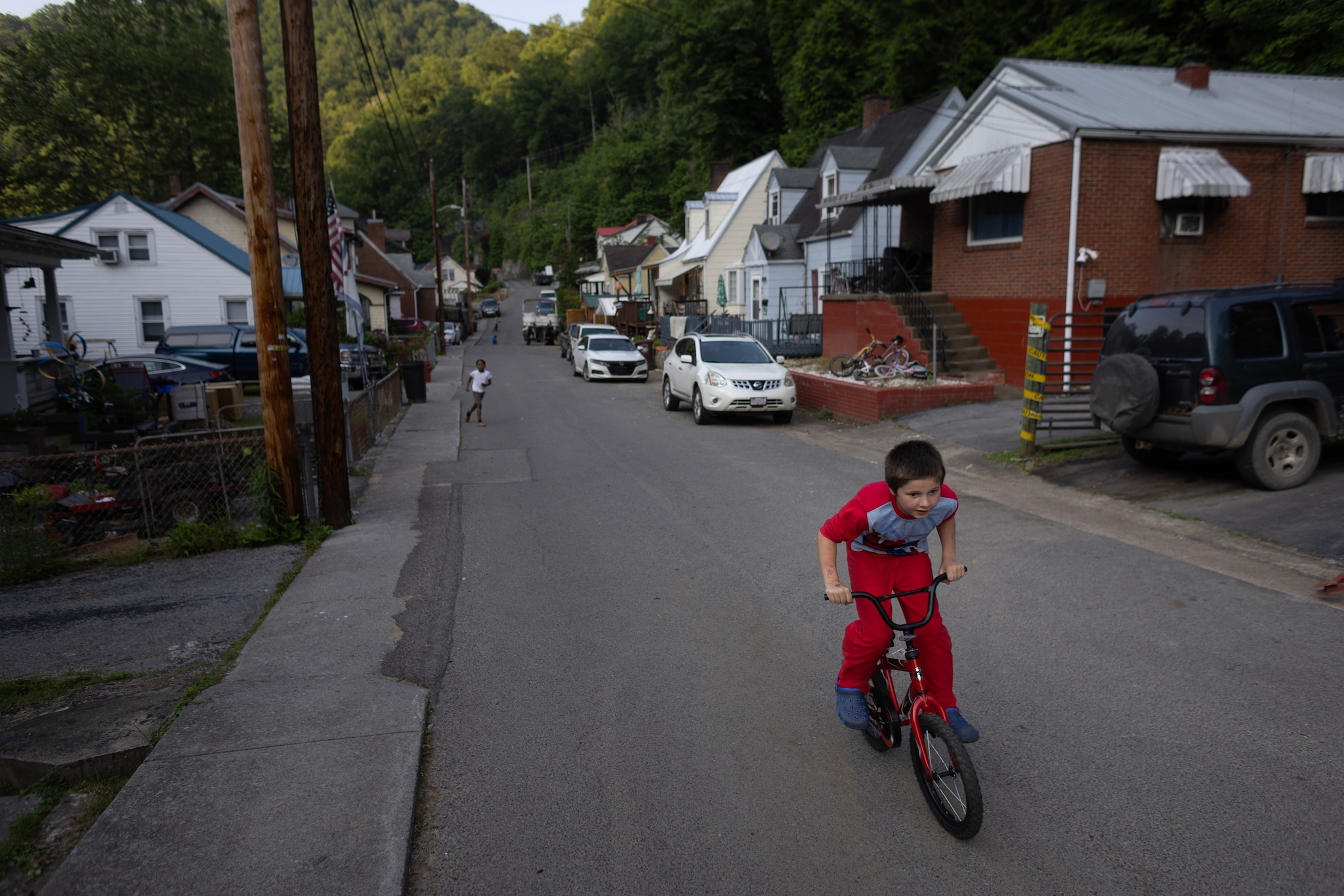
— Carol LesterAcross McDowell County, the rising water wrecked roads and bridges and left residents stranded. It swallowed cars and trucks, sent debris downstream, flooded homes and claimed three lives, including that of a 2-year-old boy. In the town of Welch, the flood swamped city hall, the library and the sheriff’s station. It also blocked the main road to the hospital.
This time, the devastation carried the fingerprints of a mostly invisible but profound atmospheric shift: As the air gets warmer and wetter over time, states within central Appalachia lie within a region particularly vulnerable to the extreme rainfall and the flooding that often follows.
To understand how that increasing moisture in the skies has driven these downpours, The Washington Post examined a metric called integrated vapor transport (IVT) — which characterizes where plumes are flowing from and their intensity. Across much of the planet in recent decades, the analysis has found rising temperatures and shifting wind patterns have waterlogged the atmosphere, raising the odds for more destructive, torrential rainstorms that can cause floods.
That is true in swaths of the eastern United States, as well as parts of California and other states in the Intermountain West, where atmospheric rivers rising from the Pacific Ocean are slamming into the region with increasing force.
But some hot spots in the American West and Northeast are wealthier and have homes and businesses distributed over a wider area, which help make them less vulnerable to punishing storms.
In central Appalachia, the changes high above are exacerbating devastation below in an area where mountainous terrain, widespread poverty and infrastructure built along snaking waterways makes preparing for floods difficult — and recovering from them that much tougher.
The broader hot spot in the East is one of the longest ones in the world — stretching about 2,000 miles from Florida to Newfoundland, an expanse that is home to roughly 131 million people.
Trends dating to 1992 show that central Appalachia sits in an area where this conveyor belt of moisture has increased at some of the highest rates anywhere in the nation. A Post analysis of 75 years of rain gauge data for central Appalachia shows that the area now experiences about two more days of heavy rainfall each year, a 35 percent increase compared to 1950.
And in central Appalachia — in a swath where around 8 million people live in cities like Knoxville, Tennessee; Asheville, North Carolina; and Charleston, West Virginia — warming waters in the Gulf create plumes that repeatedly flow across the mountainous region. In West Virginia and Kentucky, for example, around 79 and 93 percent of land area respectively has seen moisture flows increase significantly, repeatedly driving heavy rain.
Sometimes, heavy rains that hit these hot spots come as a relief, helping to break droughts. But more often, they arrive as the kind of deluges that can trigger damaging floods.
Again and again in recent years, some of central Appalachia’s most devastating disasters have unfolded during periods when plumes of intensely moist air fueled catastrophic rainfall.
Such moisture drove the storms in southern West Virginia earlier this year and those the year before. It helped to fuel 2022 floods in eastern Kentucky and April’s floods in northern and western Kentucky. A historic storm battered much of West Virginia in 2016, when as much as 7 inches of rain fell over a period of 24 hours, with flash floods killing at least 23 across the state.
The region’s floods have claimed nearly 300 lives since 2000, on average about a dozen per year, a Post analysis of National Weather Service storm events data found.
The trend shows no signs of slowing. As long as the planet keeps warming, the atmosphere’s capacity to hold water will increase — at about 4 percent per degree Fahrenheit.
Chart showing heavy rain days in Central Appalachia
“It’s going to continue to intensify and get worse, and it’s going to happen more frequently,” said Nicolas Zegre, director of the Mountain Hydrology Lab at West Virginia University, whose work is focused on trying to help communities in the region become more resilient to extreme weather events.
“We are underprepared in so many ways.”
But preparation is complicated, and not just because it’s hard to predict where the next flood will hit.
So much of what humans have built in Appalachia is susceptible. That includes homes, businesses, railroad tracks and fire stations.
According to the West Virginia Flood Resiliency Framework created by researchers at WVU, the state has more than 80,000 structures that lie in a zone deemed high-risk by the Federal Emergency Management Agency. Nearly 200,000 residents also live in these areas.
And other factors, including waterways that have long been choked with debris, only exacerbate the rain’s impact.
Flooding, Zegre and others are quick to note, is just one of the many challenges of life here and elsewhere in Appalachia. The area is among the poorest in the nation. It has endured the opioid epidemic, population loss and the decline of the coal industry.
“Before the disaster even strikes, communities are already stressed,” Zegre said. “There’s food insecurity, there’s drinking water insecurity, there’s employment insecurity, there’s poor public health.”
All that combined, he said, leaves many Appalachian communities “in a precarious place.”

Carol Lester is among the stressed, wondering what lies ahead.
“This one, it wasn’t normal,” she said of the February storm one afternoon in the living room with donated furniture and the new floor her brother had installed to replace what got ruined. “The water came down so fast, and then it rose so fast. … There was water coming from places I’ve never seen water come from.”
She and her husband, John, are back in their home. But even as she says how grateful she is for that, she gestures at the water line still visible on her front door, and the babbling brook out front.
“The next flood that comes, there might not be any house.”
‘Ground zero for flooding’
So many floods have hit the region in recent years, they have become impossible to ignore.
“It rains harder and more often than any time I can remember,” said Rodney Fouch, the city manager in Morehead, Kentucky, 60 miles east of Lexington. “We get closer [to flooding] a lot more often.”
That was evident last year, when Hurricane Helene dumped biblical rains across five southern Appalachian states. Most deadly in western North Carolina, the floods that followed also killed residents, destroyed homes and wrecked roads in South Carolina, Tennessee, Virginia, Georgia and Florida.
“If we can’t use the rainy day fund for a literal rainy day, why does it even exist? If we can’t use it for an actual emergency, then why do we have it?”
— Rev. Brad DavisWhen the flooding hit southern West Virginia in February, the rains also sent rivers rising through Tennessee, Virginia and eastern Kentucky, where nearly two dozen people died. The storm brought reminders of Kentucky’s 2022 flood.
“It happens so often now, you kind of forget the year and the time,” Fouch said.
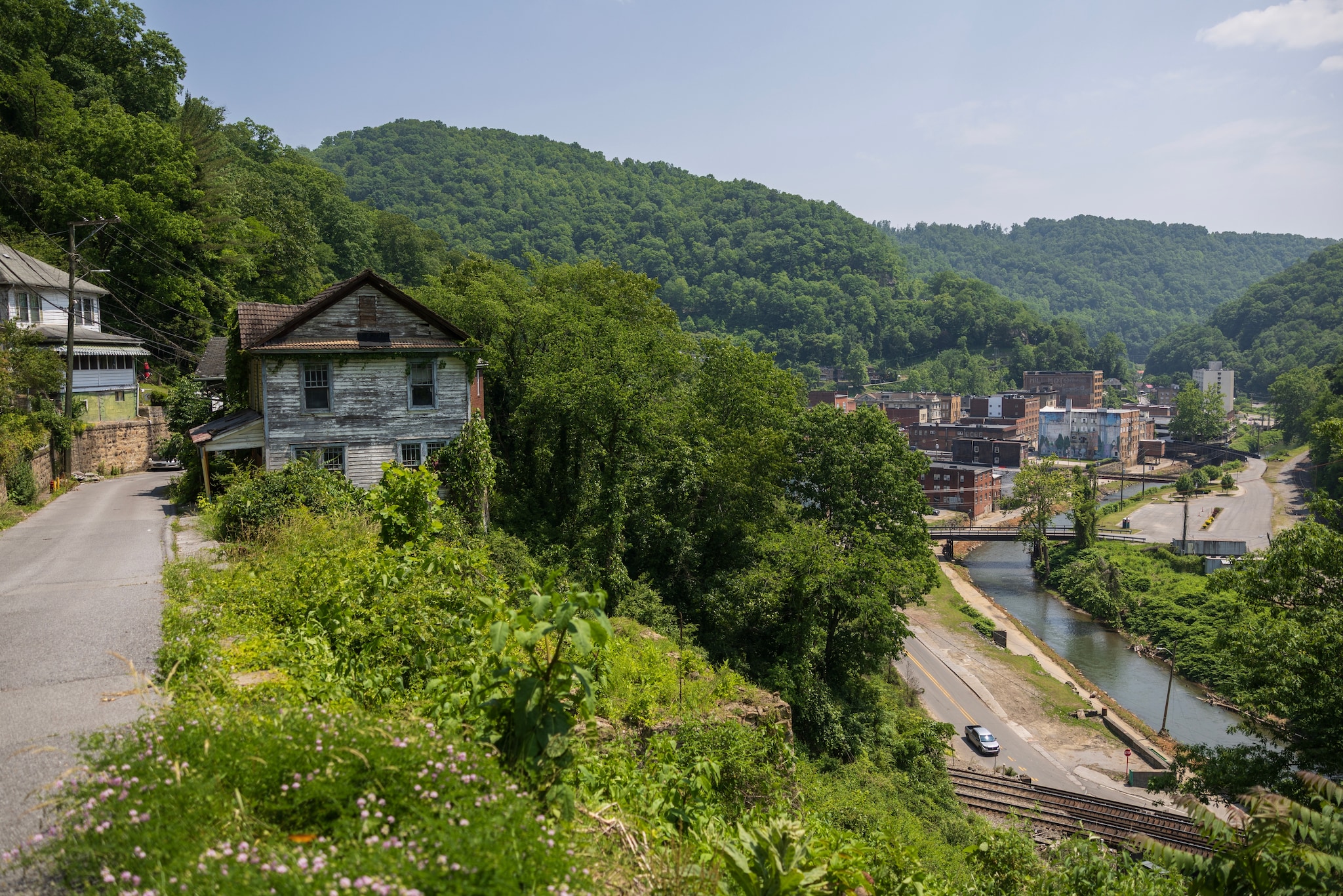
If there’s a bull’s eye to the Appalachian flooding hot spot, it’s the hollers where Kentucky meets West Virginia.
Map key explaining the colors on the following map representing the share of properties in U.S. counties facing risk of extreme damage from flooding
Map showing the share of homes at risk of extreme damage from flooding in U.S. counties. 29% of homes in McDowell County, West Virginia are at risk. Data on the map is from Cotality.
Of the 16 U.S. counties that have experienced the most frequent federally declared flooding disasters since 2004, 11 of them are in Kentucky, according to a Post analysis of FEMA disaster declarations. In three of those Kentucky counties, there has been an average of one federally declared flooding disaster every year for the past two decades.
Especially in eastern Kentucky, floodplains tend to be among the only places flat enough for towns to grow, said Brian Storz, the Licking River basin coordinator for the Kentucky Division of Water.
“We’re kind of ground zero for flooding,” Storz said.
There, and in other parts of Appalachia, that recognition is starting to spur more action.
In the hardest-hit Kentucky counties, the U.S. Army Corps of Engineers launched a study this year of how to lower flood risks in the future, whether through infrastructure like dams or levees, or measures such as buyouts of at-risk buildings. The study process typically takes three years, but could take longer given that it covers such a large area, said Laura Mattingly, chief of the planning formulation division of the Army Corps’ Louisville district office.
West Virginia will soon embark on two similar studies, its governor announced this summer, nearly a decade after the crippling 2016 floods that spurred calls for ways to protect vulnerable valley towns.
Officials have been working for years on a project that would guard the West Virginia town of Milton from floodwaters flowing out of the Mud River. And they have acknowledged the project’s rising importance, estimating that if it experienced what is considered a 100-year flood event, waters would inundate some 650 buildings.
In east Tennessee, there are efforts to plant hundreds of trees across the barren stretches of packed soil where mines once stood, so that more rain is absorbed into the soil instead of flowing into the Cumberland River. It flows to Nashville, where there are also efforts to increase tree cover and remove pavement to reduce runoff, said Mekayle Houghton, executive director of the Cumberland River Compact.
The hope is that, even if the efforts cannot stop the most disastrous flooding, they can limit the damage, Houghton said.
In Kentucky, there are ongoing efforts to build entire new communities at higher ground — in some cases, atop former mines. Researchers also are working to develop improved warning systems to detect signs of floods earlier.
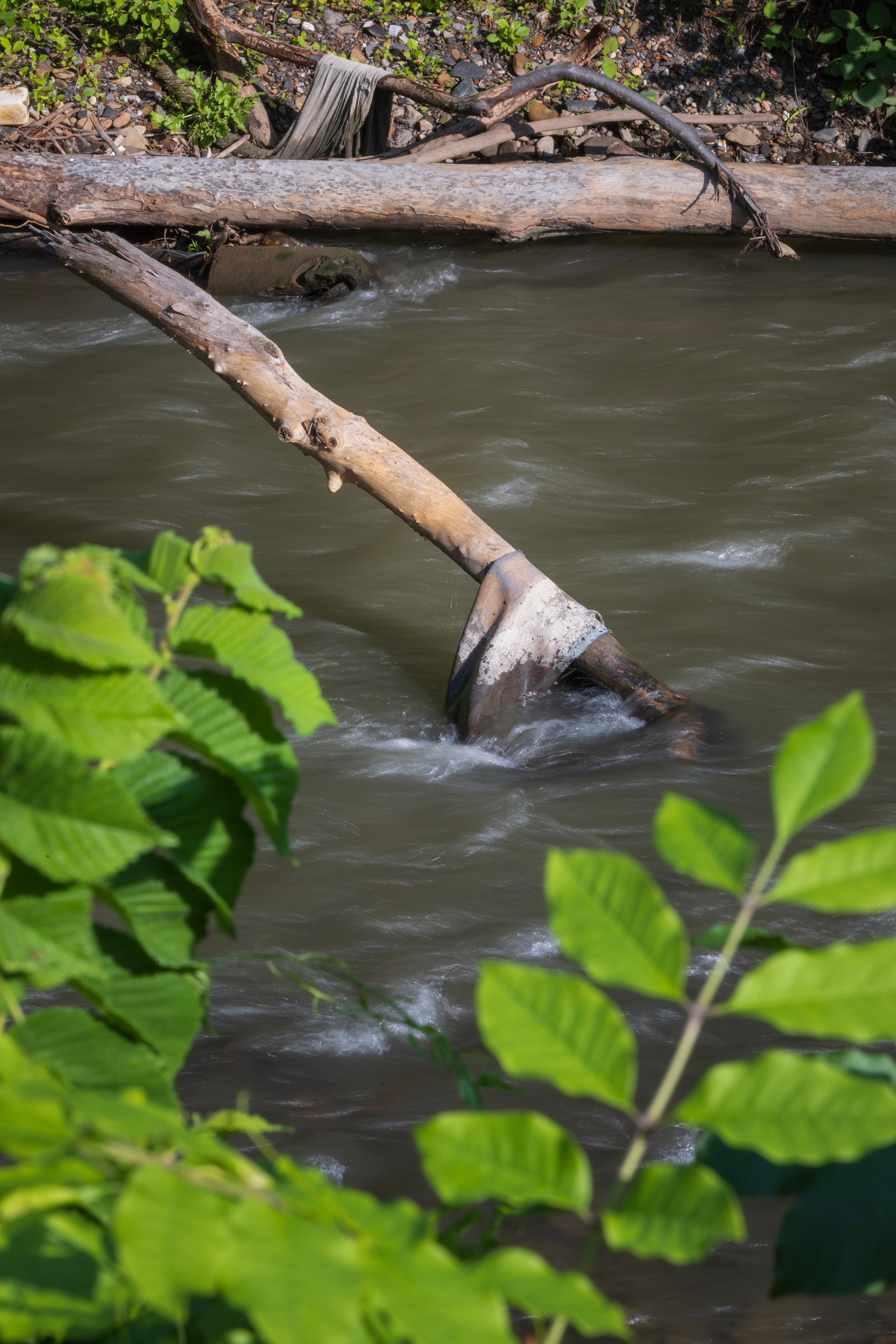
Scientists have estimated that for every mile of any steadily flowing stream, there are about 10 miles of ephemeral streams that feed it, said Christopher Barton, a professor of forest hydrology and watershed management at the University of Kentucky.
Such streams are shallow, narrow and usually dry gullies, and they quickly fill up in a downpour. When many of these small tributaries begin gushing into rivers at once, even the larger waterways can rise quickly and overflow their banks.
When a torrent comes, Barton said, “It doesn’t take long to overwhelm those systems.”
In eastern Kentucky, some communities are mulling projects that could lower floodwaters by even a few inches. Storz is working with nearly two dozen towns and county governments on plans to widen and deepen floodplains to allow for water that perennially overflows from tributaries of the Licking River.
Engineering estimates suggest that in Morehead, that effort could lower floodwaters by at least a few inches, Fouch said.
“Two inches doesn’t sound like a lot, unless you’ve had 2 inches in your house before,” he said.
Work to explore the idea, which organizers have dubbed “green sinks,” is funded through FEMA grants that have been frozen by the Trump administration.
For now, state and local officials are left hoping the agency will still be able to help the project move to the engineering and construction phase, or that some other source of funding will materialize.
Trying to prevent ‘so many heartaches’
On a Friday in early April, lawmakers in West Virginia’s capital paused for a moment of prayer for flood victims in the state.
House Minority Leader Sean Hornbuckle (D-Cabell) soon rose. Prayers alone were not enough, he said. “We have the ability to do something earthly.”
He had proposed to set aside $250 million — with half of it coming from the state’s $1.4 billion rainy day fund — to help communities in the state better prepare for floods. When that failed, he led an effort to earmark $50 million in the state budget to go toward flood mitigation projects. That proposal failed, too.
“It’s just the worry of, is it going to happen again?”
— Linda PearsonFor Hornbuckle, there is an economic argument to be made that the state could avoid costly flood damages on the back end with some up-front investment, as well as lessen unemployment and job loss. But also, he said, “It’s a moral issue. We have the obligation as a state to help our residents when they are in need.”
But his efforts, like those before, so far have foundered. In 2023, with the backing of then-Gov. Jim Justice (R), lawmakers had created a Flood Resiliency Trust Fund intended to help struggling communities adapt and prepare for the flood risks.
Years later, the trust has yet to be funded.
Gov. Patrick Morrisey (R), whose office did not respond to requests for comment, has acknowledged more extreme rainfall will come. He said he wants to ensure the state is learning from each flood, using damage assessments and post-disaster reviews to guide preparations for the next catastrophe.
But he also has stressed how difficult those preparations can be.
“It’s pretty unbelievable,” he said during a June news conference after yet another deadly bout of flooding struck northern parts of the state, adding, “You could have large areas where there’s some rain but then in one concentrated area it’s a torrential downpour, and you’re seeing massive quantities of water dumped. It’s just Mother Nature at its worst. And so, it’s not something that’s easy to foresee.”


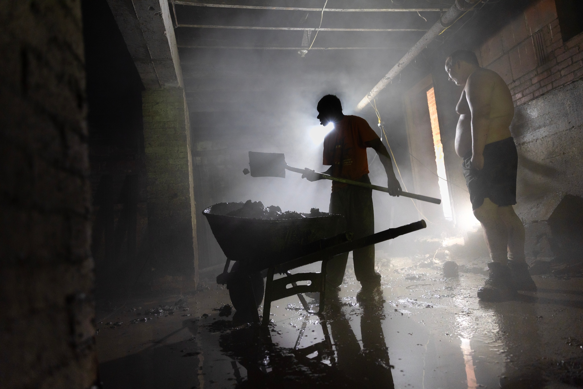
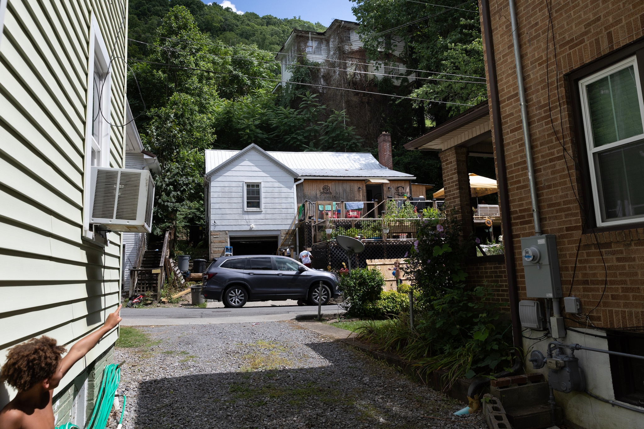
As lawmakers debated in the state capital and flooding plagued other parts of the state and region, recovery remained a struggle in McDowell County.
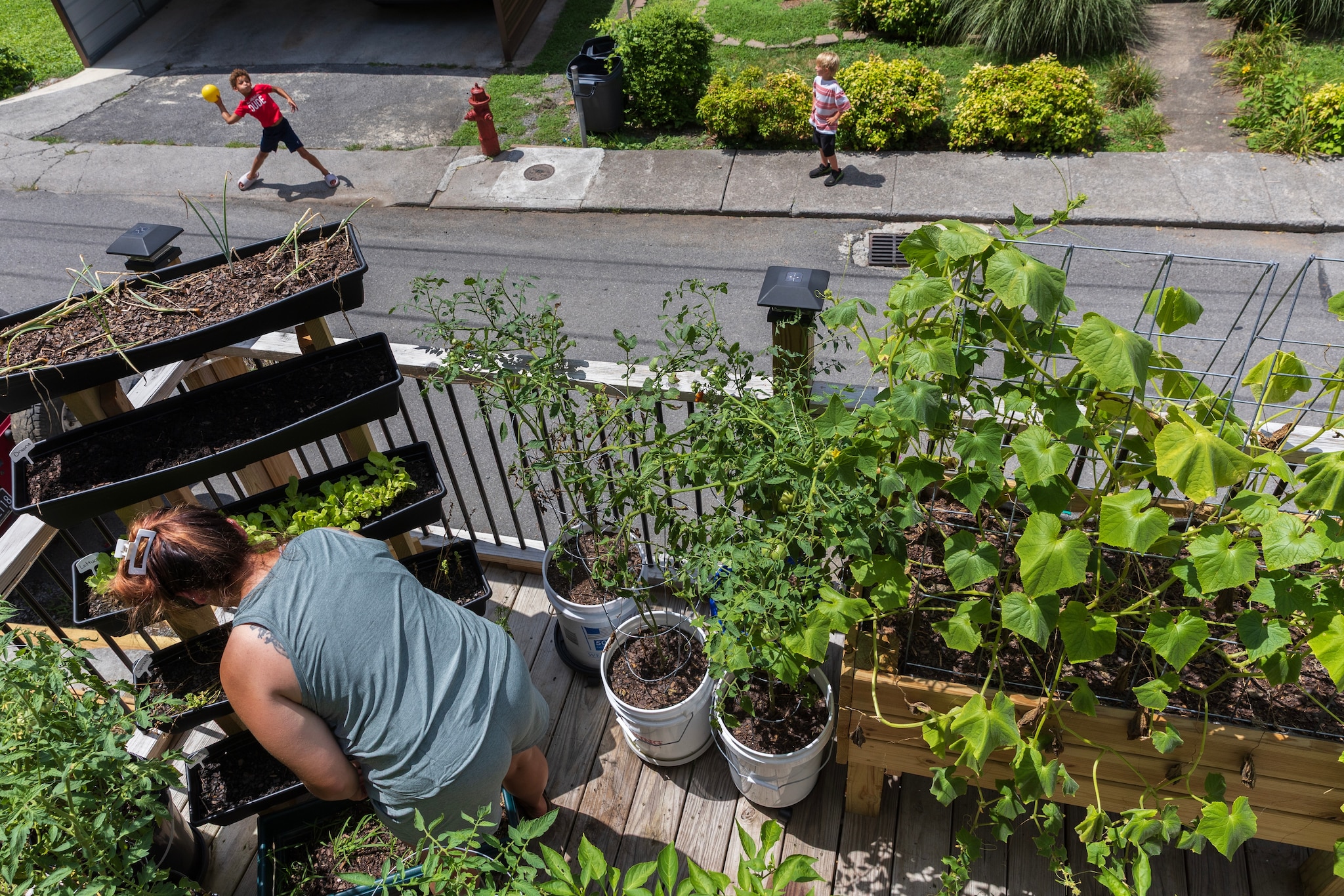
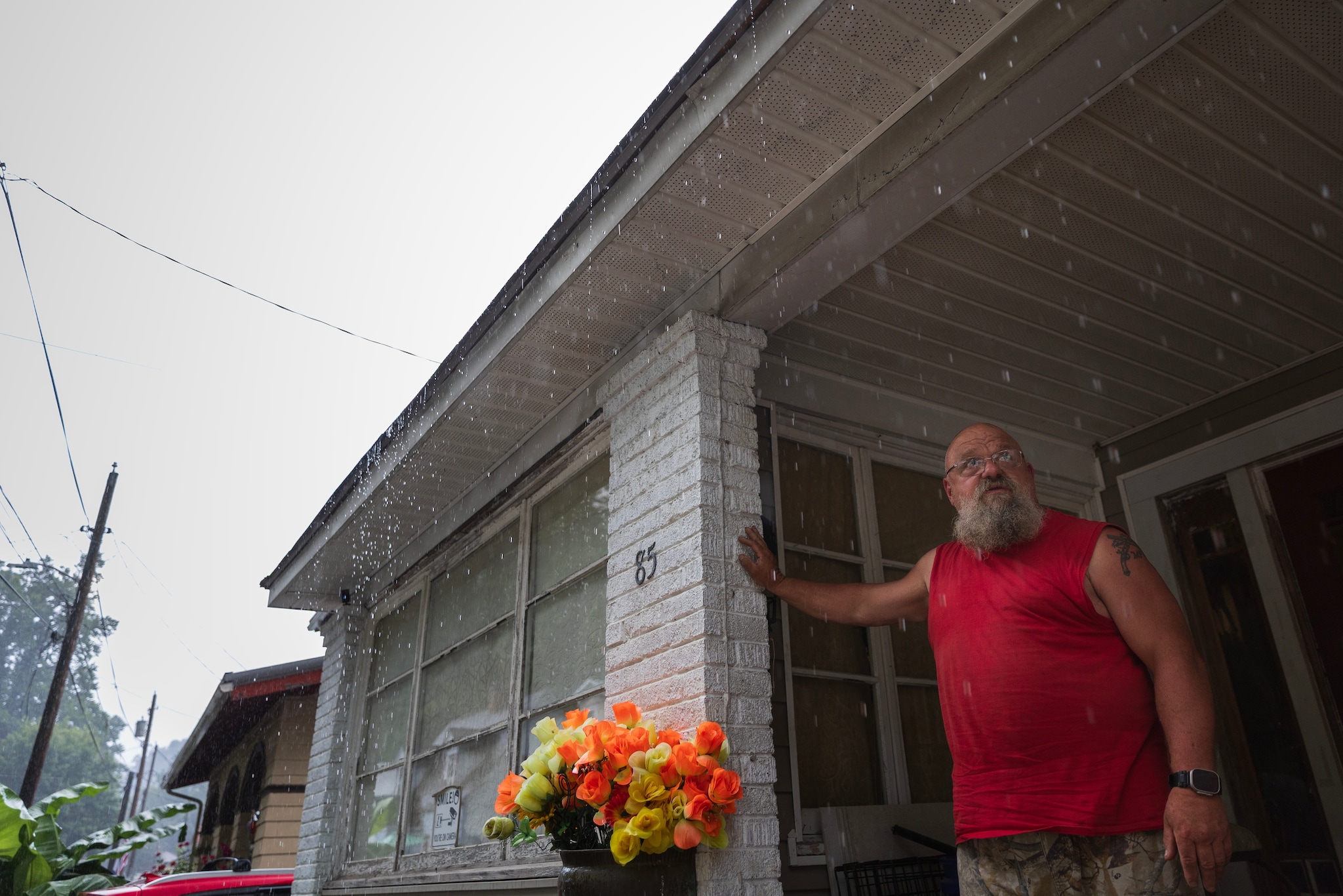
Long after the February floods, piles of debris and ruined appliances sat stacked in yards and driveways. Many houses remained unlivable or in various states of disrepair. Some residents decided to forego planting gardens over the summer, fearful of what contaminated floodwaters had left behind.
The looming threat of future floods only compounds the unease. In the small community of Berwind, Linda Pearson keeps jugs of bleach on her basement stairs as she tries to keep the mold at bay and continues to eye a nearby creek.
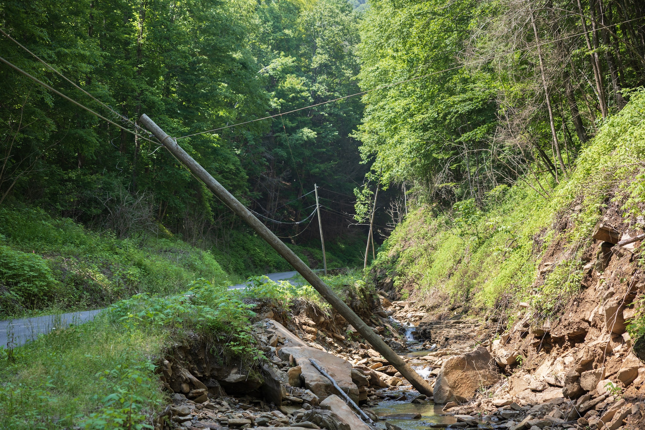
She finds it hard to rest when it rains and stays awake watching the creek that not long ago swallowed part of her home. “I have a bag packed, and I keep it by our bed,” she said.
The Rev. Brad Davis, who pastors five local United Methodist congregations, has been displaced ever since he fled the rising waters inside his Welch home on Lake Drive. It was built in 1950, but until this year had never flooded on the main living area. For now, he still lives in a spare apartment owned by one of his parishioners.
“I’m not a scientist, but it seems to me as though the amount of rain being dumped is increasing in a much shorter time window,” said Davis, who grew up in nearby Mingo County.
He has been an outspoken critic of the state’s lack of action, and has pushed lawmakers in Charleston to fund the state’s flood resiliency efforts.
“We have got to do some things to help ourselves, because it’s going to happen again.”
— Mayor Harold McBride“If we can’t use the rainy day fund for a literal rainy day, why does it even exist?” he said. “If we can’t use it for an actual emergency, then why do we have it?”
Welch Mayor Harold McBride said he has written to state officials too, asking for more money to build flood walls and an overpass along an especially problematic road in town.
At the same time, McBride said, people here take pride in their ability to carry on and persist without outside help. Even the mayor has spent the months since the February flood helping to rebuild parts of town himself — on a June day, he was part of a crew racing to restore the Coaltown Creamery, a city-run ice cream shop, ahead of a weekend festival in town.
Still, he is hopeful help will come — from the governor, from FEMA, from anywhere. But he also knows residents can’t wait around for support that might never arrive, that they must figure out how to better protect this place from the water that can change so much in a flash.
“In the past, the only thing we do is shovel the mud and forget about it,” he said. “But we have got to do some things to help ourselves prepare, because it’s going to happen again.”
About this story
Story editing by Paulina Firozi, Simon Ducroquet, Anu Narayanswamy and Katie Zezima. Additional editing by Juliet Eilperin. Photo editing by Dominique Hildebrand. Video editing by John Farrell. Copy editing by Gaby Morera Di Núbila.
Design and development by Talia Trackim and Hailey Haymond. Design editing by Betty Chavarria.
Methodology
To examine trends in heavy rainfall The Post analyzed 75 years of rain gauge data from 28 stations in three central subregions of Appalachia produced by NOAA’s National Centers for Environmental Information. The area encompasses all of West Virginia and portions of Ohio, Kentucky, Virginia, North Carolina and Tennessee.
To define what counts as a heavy rainfall day, The Post used the period from 1950 to 1989 as the base for determining the 95th percentile precipitation event at each station. Days with at least 0.5 millimeters of precipitation were included. Using a simple linear regression, The Post measured the change in frequency of the 95th percentile rain events at each station from 1950 to 2024.
The analysis showed a significant positive trend in 95th percentile rain events in the central regions of Appalachia, where the number of days each year with heavy rainfall has increased by two, a 35 percent increase.
To investigate global changes in extreme precipitation, The Post measured the amount of water vapor flowing through Earth’s atmosphere, a metric called integrated vapor transport (IVT). The analysis also identified days and locations where heavy rainfall coincided with high IVT. See more about The Post’s methodology for the IVT analysis here.