
Mixing Is the Heartbeat of Deep Lakes. At Crater Lake, It’s Slowing Down.
climate science Mixing Is the Heartbeat of Deep Lakes. At Crater Lake, It’s Slowing Down. By Rachel Nuwer November 14, 2025 The physics of mixing water layers — an interplay of wind, climate and more — makes lakes work. When it stops, impacts can ripple across an ecosystem. Katie Falkenberg for Quanta Magazine climate science Mixing Is the Heartbeat of Deep Lakes. At Crater Lake, It’s Slowing Down. By Rachel Nuwer November 14, 2025 The physics of mixing water layers — an interplay of wind, climate and more — makes lakes work. When it stops, impacts can ripple across an ecosystem. By Rachel Nuwer Contributing Writer November 14, 2025 animals biology climate science ecology physics All topics On a radiant July afternoon, a pair of scientists hung their heads off the side of a boat and peered into the brilliant blue water of a lake known for its clarity. They were watching for the exact moment when a black-and-white, dinner plate–sized object called a Secchi disc disappeared from view in the water column of Crater Lake in Oregon. The disc was being slowly lowered by crane, spinning lazily like a carnival prop. A minute or so after it hit the water, graduate student Juan Estuardo Bocel gave a shout to indicate that he could no longer see the disc: “I am out!” Seconds later, researcher Eva Laiti echoed: “OK, I’m out!” The crane operator, Scott Girdner, a lanky freshwater biologist who has spent most of his adult life at Crater Lake National Park, recorded the disc depth for each call. Then he slowly raised it until the junior researchers piped up again when it was back in view, and he recorded those depths, too. The mean of those readings, known as the Secchi depth, has been used as a simple and dependable measure of water clarity since 1865, when the Italian Jesuit priest Angelo Secchi invented it at the behest of the papacy. The value recorded that afternoon in 2025 — about 78 feet (24 meters), an unusually cloudy reading for Crater Lake — is now part of one of the world’s longest-running datasets on lake physics. The lake’s first Secchi reading was taken in 1886, and in 1983 scientists began to repeat the procedure several times per month every summer. When it comes to lake health, long-term data is treasure. Crater Lake’s size, natural beauty and otherworldly clarity — a reflection of its setting and isolation — make it one of the world’s most iconic freshwater bodies. With a maximum depth of 1,949 feet, it is the deepest lake in the United States. It’s also very likely the clearest large lake on Earth, with a vivid blue hue seldom encountered in nature. Share this article Copied! Newsletter Get Quanta Magazine delivered to your inbox Recent newsletters To measure water clarity, Scott Girdner and Taryn Weller, biologists at Crater Lake National Park, lower a black-and-white Secchi disc (right) and record the depth at which it vanishes. Crater Lake’s first Secchi reading was taken in 1886. Katie Falkenberg for Quanta Magazine “People are just amazed and wowed at the optical blue that you see from pure water itself,” said Sudeep Chandra, a limnologist at the University of Nevada, Reno, who collaborates with Girdner. “That blueness is the reflection of the hydrogen and oxygen hanging out together without any material in it.” Since 2010, however, Girdner and his colleagues have noticed an unexpected change in the Secchi data: Despite the day’s slightly cloudy reading, Crater Lake’s clear water is getting even clearer. This might sound like a good thing. After all, the lake’s remarkable, glasslike transparency and brilliant hue are major draws for the half-million tourists who visit every year. But it might also indicate that something is going wrong with the lake’s physics, chemistry and ecology, and it could be a harbinger of changes to lakes across the world in the age of climate change. As the planet warms, summers are growing longer and winter nights aren’t getting as cold as they used to. As a result, the surfaces of many deep, temperate lakes are warming even faster than the air. This shift to the energy flux of the top layer of water can set in motion a series of physical changes that add up to a breakdown of lake mixing — a fundamental process that acts like a heartbeat for deep, temperate lakes that don’t freeze in winter. Lake mixing is driven by physical properties such as wind, air temperature, water temperature and salinity, and on seasonal or annual cycles it circulates water between the surface and the depths. When mixing stops, oxygen and nutrients don’t get distributed throughout the water column, which can kill fish, trigger unsightly and dangerous algal blooms and invite invasive species to take over. “Many people visit Crater Lake because of its pristine water quality and blueness,” said Sudeep Chandra of the University of Nevada, Reno. “What happens if that changes?” Katie Falkenberg for Quanta Magazine From Italy to New Zealand and beyond, scientists have been alarmed to observe reduced lake mixing. In 2021, Chandra and his colleagues published evidence in Nature of greater stratification in the water column over time — an indicator of weaker mixing — in 84% of 189 temperate lakes for which they could find sufficiently long and robust datasets. Some lakes had stopped mixing altogether. “While each system is unique, the endgame is generally the same: a lack of mixing for these large, deep lakes,” Chandra said. Of the world’s millions of lakes, Crater Lake is one of very few with a monitoring program that stretches back more than 40 years. Scientists are now beginning to realize how crucial those datasets are for unraveling lake physics and how climate change is altering it. “Because local weather can be extremely variable from year to year, it takes many years to capture the range in conditions and measure ‘normal,’” Girdner said. “Hence the advantage of long-term datasets.” Crater Lake is therefore at the center of the first efforts by researchers, including Girdner and Chandra, to compare lake systems to get to the bottom of their breakdown, so they can prepare for the future and perhaps even ward off the most extreme impacts. “Historically, people have studied lakes one at a time,” said Stephanie Hampton, director of the Tahoe Environmental Research Center at the University of California, Davis. In light of how quickly things are changing, that siloed approach no longer works, she said. “We need to learn from each other and synthesize these data to understand what’s happening globally.” In July 2025, researchers journeyed to the remote research station on Wizard Island, the volcanic cinder cone near the western shore of Crater Lake. On the boat dock they ate their meals (including fresh-caught invasive crayfish) and slept out under the stars. Katie Falkenberg for Quanta Magazine Canary in the Lake In 2006, five deep lakes in northern Italy — Iseo, Como, Garda, Maggiore and Lugano — stopped fully mixing. At first, scientists didn’t think much of it. They had been monitoring the lakes since the 1980s and 1990s, and it was normal for a few years to go by without complete mixing. But as time passed and the clear waters remained stubbornly in place, they began to fear that the pause might be permanent. Their fears seem to have been borne out. “It’s been 20 years that we haven’t observed any full mixing from the top to the bottom,” said Barbara Leoni, a freshwater ecologist at the University of Milan-Bicocca. “I don’t know that it will be possible to return to the past behavior.” While each system is unique, the endgame is generally the same: a lack of mixing for these large, deep lakes. Sudeep Chandra, University of Nevada, Reno Lake mixing is a function of the fact that water has different densities at different temperatures. In deep temperate lakes, this creates stratification in the water column: Lighter, warmer water floats on top, and colder, denser water sinks below. Any number of factors can influence mixing, but it is primarily driven by seasonal temperature changes, wind and waves. Because these features vary from place to place and from lake to lake, mixing does not follow a single formula. In many lakes, complete mixing occurs once or twice a year, usually in spring and fall. In very large lakes, mixing might happen in the shallow upper waters on annual or seasonal cycles, while full mixing to the deepest bottom layer may occur only every few years. By studying different lakes, scientists are hoping to find shared rules. Italy’s deep northern lakes previously achieved complete mixing on an approximately seven-year cycle. During the summer, the lake water would maintain distinct layers as surface waters warmed and remained light and in place. As surface temperatures dropped in autumn and winter, the layers would become closer in temperature; with a push from the wind, the lake would begin to mix. This redistributed heat, oxygen, nutrients and toxins throughout the water column. Researchers pull in a gill net to assess fish populations. Katie Falkenberg for Quanta Magazine That’s not how the Italian lakes work anymore, however. Now, the surface waters fail to get cool enough to sink and trigger mixing. As a result, oxygen is disappearing from the bottom of the stratified lake. It has already been depleted entirely in Lake Iseo. “We have 150 meters of water without oxygen,” Leoni said. This kills off oxygen-breathing life at depth and transforms the biological community. “In lakes where the deep waters have been oxygen-free for a long time, only bacteria survive,” she said. The hearts of Italy’s deep lakes have stopped and are no longer circulating nutrients; they show what can happen when lakes stop mixing. Crater Lake offers a different opportunity: to study how, exactly, warming temperatures can break the fundamental physics of a lake. Mixing Mix-Up On summer days, viewed from the rim of the ancient caldera that holds it, Crater Lake is a perfect mirror reflecting the procession of clouds and colors of the sky above. But beneath that glassy surface, dynamic processes are underway. Scott Girdner, a freshwater biologist at Crater Lake National Park, has run the lake’s long-term monitoring program since 1995. He will retire at the end of 2025. Katie Falkenberg for Quanta Magazine Compared to many other large lakes around the world, Crater Lake is close to pristine. It is surrounded by wilderness and protected as a national park. The air above it is mostly wind blowing off the Pacific Ocean, with few polluting cities or industries nearby. The lake lacks any rivers or streams emptying into it that could bring in pollution from elsewhere; it is filled by rain and melting snow. In July, Girdner and Chandra filled two large water coolers with lake water — enough to keep the team of around 13 visiting scientists, students and National Park employees, plus a journalist and photographer, hydrated overnight. The lake’s water tasted as pure as bottled water, and it maintained a natural, refreshing temperature under the blazing summer sun. Crater Lake has gained 33 additional days of summer weather per year over the past 60 years, as spring arrives earlier and earlier. The water purity does more than provide good drinking: It makes Crater Lake an ideal system for studying climate impacts. Without the confounding factors of agriculture, sewage, parking lot runoff and water withdrawals that tend to affect other lakes, Girdner said, “it’s easier to see the influence of climate change.” Girdner started working at Crater Lake in 1995 and has overseen the long-term monitoring program ever since. He often tells his staff that it’s not enough to just record change; they must also understand its drivers and its implications for the lake’s physics, chemistry and biology. To that end, every night at 8 p.m., a tube-shaped profiler instrument crawls along an anchored metal cable from a depth of 585 meters to Crater Lake’s surface and back down again. On this round trip, it tests twice a second for water conductivity, temperature, oxygen and salinity. Other sensors use light to measure chlorophyll fluorescence and phytoplankton particle density. That dataset and others tell the story of Crater Lake’s health across time. Like virtually all lakes around the world, it’s getting warmer: Average surface water temperatures have increased by 3 degrees Celsius since 1965. In summer, nighttime air temperatures are increasing faster than daytime ones; the coldest summer nights are not as cold as they used to be. And there are more summer nights: Crater Lake has gained 33 additional days of summer weather per year over the past 60 years, as spring arrives earlier and earlier. The remoteness that makes Crater Lake ideal for isolating climate change impacts also makes it a top location for stargazing. On average 98.6% of potentially visible stars can be seen at the site, according to NPS data. Katie Falkenberg for Quanta Magazine In the past, when summer nights grew cold, the lake released the day’s accumulated heat, causing surface water to become denser and sink. This phenomenon drives the shallow mixing that occurs in summer. As nights have warmed, however, this process has weakened, and mixing has slowed. Counterintuitively, as the layer of surface water has become warmer, it has also become thinner. “In the summer, there is half as much warm water floating on the surface now, on average, than there was in 1971,” Girdner said. This creates a sharper density difference with the cold water below, which in turn increases the amount of wind energy required to break through and mix the layers. I think about it like a vinaigrette. There’s resistance to mixing. Kevin Rose, Rensselaer Polytechnic Institute “I think about it like a vinaigrette,” said Kevin Rose, a freshwater ecologist at Rensselaer Polytechnic Institute in New York who collaborates with Girdner and Chandra. “There’s resistance to mixing.” So what does all of this have to do with the fact that the lake is getting clearer? That’s where biology comes in. In Crater Lake’s warm surface water lives a community of phytoplankton. A thinner warm surface layer means less habitat, so there are fewer phytoplankton, which means fewer particles in the water to scatter light. This boosts the water’s clarity overall and the depth to which light can penetrate. Crater Lake’s winter processes, which mix the lake all the way to the bottom, are undergoing their own profound changes. These transformations involve the weakening of a phenomenon called reverse stratification, in which a layer of very cold water, cooled by frigid winter air, forms on top of a slightly warmer layer that is around 4 degrees Celsius, the temperature at which water is heaviest. (At temperatures below that, water molecules begin to organize into lighter ice crystals.) When strong wind pushes the extra-cold surface water horizontally, as it approaches the lake’s edge some of it is forced down. If it is pushed down far enough, the increased pressure causes it to become denser than the 4-degree water layer. It then sinks to the bottom in a matter of hours, creating a mixing effect. Mark Belan/Quanta Magazine Historically, reverse stratification occurred during 80% to 90% of Crater Lake winters. As winters warm, it is becoming less common. “Crater Lake is sitting on a knife edge where it’s already really close to not being able to form reverse stratification,” Girdner said. This does not bode well for the lake’s future mixing. When Girdner’s colleagues used his data to simulate what might happen under a range of climate scenarios, the model predicted that reverse stratification will become rare within about 50 years. If the process stops entirely, Crater Lake will no longer mix to the bottom at all. Over decades, an oxygen dead zone will begin to form — similar to the ones in the northern Italian lakes. This risks significant ecological impacts, as well as a buildup of toxic compounds that could billow up to the surface if the lake does mix again. Crater Lake is just starting on the path toward such dramatic changes. Another iconic lake a few hundred miles away suggests what might happen next. A Trickle-Down Effect Lake Tahoe, the second-deepest lake in the United States, on the California-Nevada border, once rivaled Crater Lake in its clarity. In the 19th century, rocks glistened through its crystal-clear water. Then, rapid population growth in the 1950s polluted the water, causing algae to start growing offshore. In recent years, those algae have advanced into shallower waters. Secchi disc readings show that, since 1967, clarity in Lake Tahoe has been reduced by nearly 40 feet. The lake’s formerly rich blue hue is now diminished in some places. Jaden Bellamy, a biological science technician at Crater Lake National Park, monitors the lake’s wildlife, including invasive crayfish (left) and rainbow trout (right). Katie Falkenberg for Quanta Magazine These trends will likely continue as climate change advances, said Michael Dettinger, a hydroclimatologist at Scripps Institution of Oceanography at the University of California, San Diego. As Lake Tahoe’s mixing breaks down and summer waters get warmer and linger longer, phytoplankton enjoy an enhanced growing season and cloud the water. Over the next century, more intense and frequent storms are projected to increase water inflows, likely bringing “enormous spikes” of sediments and nutrients into the lake, Dettinger said. Smoke from wildfires also deposits particles, which can change the light structure and nutrient composition of the lake. Such events can affect a lake’s trajectory for years, Chandra said. When combined with altered lake mixing, they create a vicious ecological cycle. Algae blooms are a product of these and other disruptions. In addition to killing fish, the accumulation of oxygen-poor, nutrient-rich water that builds up in a stratified lake — especially one loaded with extra nutrients from runoff and wildfires — can leak to the shoreline, triggering nearshore algae growth that forms a green bathtub ring surrounding a clear center. “That’s one of the working hypotheses for what we think is happening in Lake Tahoe,” Chandra said. Crater Lake suffered its first bloom of shoreline algae in 2021. “It looked like someone took a massive bright green highlighter along the shore,” Girdner said. Because lake tours were closed due to the Covid-19 pandemic that summer, there was no public outcry. Had the bloom occurred during a normal summer — like July 2025, when tourists crowded the lake in passenger boats to marvel at the seemingly bottomless blue abyss around them — the situation might have made national headlines. Researchers process crayfish and fish to monitor the lake’s health. “You can measure vital signs of a human being and get some idea if something seems to be wrong or if things are changing,” Girdner said. “We do similar things in the lake.” Katie Falkenberg for Quanta Magazine When the green ring appeared, Girdner and his colleagues felt overwhelmed. At first they had no idea what could be driving the sudden growth. Then they noticed a telling detail: The greenest places were those with the highest numbers of invasive crayfish. When crayfish move into an area, the population of insect larvae and other aquatic invertebrates that graze on algae declines by about 95%. “They just hammer the insects,” Girdner said. In experiments, Girdner and his colleagues found that about seven times more algae grow in areas with crayfish compared to those without. Yet Girdner suspected there was more than crayfish at work. Those invasive predators had regrettably been introduced to the lake in 1915, but in the intervening century, no other major algae blooms had occurred. He and his colleagues found, instead, that record-breaking water temperatures during the exceptionally hot summer of 2021 had fueled the algae growth. Crayfish had just given it a boost. Milder winters have let the crayfish population grow and spread to new areas of the lake, further disrupting ecosystems. The Mazama newt (or Crater Lake newt), a subspecies found nowhere else in the world, has virtually disappeared. In addition to competing for the same invertebrate prey, the crayfish also capture newts in their pincers and devour the hapless amphibians alive. Similar climate-driven invasive species patterns have been seen in other lakes. These cascading impacts exemplify the fact that lake conditions are inherently and intimately tied to climate, Chandra said. “We cannot divorce the biological composition and interactions within a lake from the climatic conditions within the landscape.” The sun rises over the volcanic heap of Wizard Island on July 23, 2025. Katie Falkenberg for Quanta Magazine Teasing out the interactions between climate, lake mixing and ecology at Crater Lake will give research teams around the globe a blueprint for what to expect as the world continues to warm, and could be key to averting worst-case scenarios. An Uncertain Future Last year, Chandra, Leoni and other researchers were sitting in a cafe near Lake Iseo, comparing notes about climate change at their lakes, when the cafe owner interrupted. “Why do we even need to know this?” Chandra recalled him asking. “There’s not much we can do about it, so why even care?” It’s a sentiment that Chandra often encounters. He harbors hope, however, that some impacts to lakes can be slowed or avoided. While individuals cannot stop the juggernaut of climate change, he said, local interventions could make a difference. Those strategies would be context-dependent, but they could include working to balance a lake’s nutrients, controlling invasive species, cleaning up pollution, or restoring the forests and wetlands surrounding lakes. Collaborations between different groups of scientists could enhance such interventions, said Veronica Nava, a postdoctoral researcher in freshwater ecology at the University of Milan-Bicocca. “If one lake has already experienced what you’re observing, you can come up with better strategies,” she said. A buoy is attached to a mooring sensor, which measures optical chlorophyll fluorescence and turbidity. The NPS has six of these sensors around Crater Lake. Katie Falkenberg for Quanta Magazine Teamwork “is really where freshwater science is moving,” Hampton said. But such efforts are in their early days, as researchers have only started to think about comparing large lake ecosystems over the last few years. Now threats to U.S. research are rattling their newfound collaboration. “The cuts to research funding are going to hit large collaborations pretty hard,” Hampton said. The future of even Crater Lake’s exemplary scientific program is in jeopardy. After spending nearly his entire career at the lake, Girdner is retiring at the end of the year. The federal government has frozen hiring for the National Park Service, so his position will remain unfilled indefinitely. It’s unrealistic, he said, to expect his colleagues to continue the same research output on their own. “We’re going to have to pare down what we’re doing,” he said. Related: Nature’s Critical Warning System How Soon Will the Seas Rise? Simple Equation Predicts the Shapes of Carbon-Capturing Wetlands Until then, they’re focused on what they can do: adding another year’s data to Crater Lake’s history. After a busy day, Girdner steered the vessel back to the dock at Wizard Island, a volcanic cinder cone that juts out of Crater Lake like a pointy hat. In the cluttered boathouse, decades of signatures and sketches coated the wooden walls, bearing witness to the students and scientists who had made some contribution to a better understanding of the lake. Chandra boiled a few invasive crayfish until they were delectably tender, and the group ate them with dabs of hot sauce. They passed around a few bottles of prosecco to toast Girdner’s retirement. As the sun dipped low, the exhausted scientists unrolled sleeping bags on the dock. Girdner had spent countless nights on the island (more than his ex-wife had liked, he admitted). This would be one of his last. The sky’s soft gradient of pink, orange and gold slowly darkened, and the Milky Way twinkled into view. Voices faded, while bats skimmed the water’s still surface. The lake’s future was uncertain. But the urgency of protecting its natural splendor could not have been clearer.
The physics of mixing water layers — an interplay of wind, climate and more — makes lakes work. When it stops, impacts can ripple across an ecosystem. The post Mixing Is the Heartbeat of Deep Lakes. At Crater Lake, It’s Slowing Down. first appeared on Quanta Magazine

Mixing Is the Heartbeat of Deep Lakes. At Crater Lake, It’s Slowing Down.
November 14, 2025
Katie Falkenberg for Quanta Magazine
Mixing Is the Heartbeat of Deep Lakes. At Crater Lake, It’s Slowing Down.
November 14, 2025
On a radiant July afternoon, a pair of scientists hung their heads off the side of a boat and peered into the brilliant blue water of a lake known for its clarity. They were watching for the exact moment when a black-and-white, dinner plate–sized object called a Secchi disc disappeared from view in the water column of Crater Lake in Oregon.
The disc was being slowly lowered by crane, spinning lazily like a carnival prop. A minute or so after it hit the water, graduate student Juan Estuardo Bocel gave a shout to indicate that he could no longer see the disc: “I am out!”
Seconds later, researcher Eva Laiti echoed: “OK, I’m out!”
The crane operator, Scott Girdner, a lanky freshwater biologist who has spent most of his adult life at Crater Lake National Park, recorded the disc depth for each call. Then he slowly raised it until the junior researchers piped up again when it was back in view, and he recorded those depths, too.
The mean of those readings, known as the Secchi depth, has been used as a simple and dependable measure of water clarity since 1865, when the Italian Jesuit priest Angelo Secchi invented it at the behest of the papacy. The value recorded that afternoon in 2025 — about 78 feet (24 meters), an unusually cloudy reading for Crater Lake — is now part of one of the world’s longest-running datasets on lake physics. The lake’s first Secchi reading was taken in 1886, and in 1983 scientists began to repeat the procedure several times per month every summer. When it comes to lake health, long-term data is treasure.
Crater Lake’s size, natural beauty and otherworldly clarity — a reflection of its setting and isolation — make it one of the world’s most iconic freshwater bodies. With a maximum depth of 1,949 feet, it is the deepest lake in the United States. It’s also very likely the clearest large lake on Earth, with a vivid blue hue seldom encountered in nature.
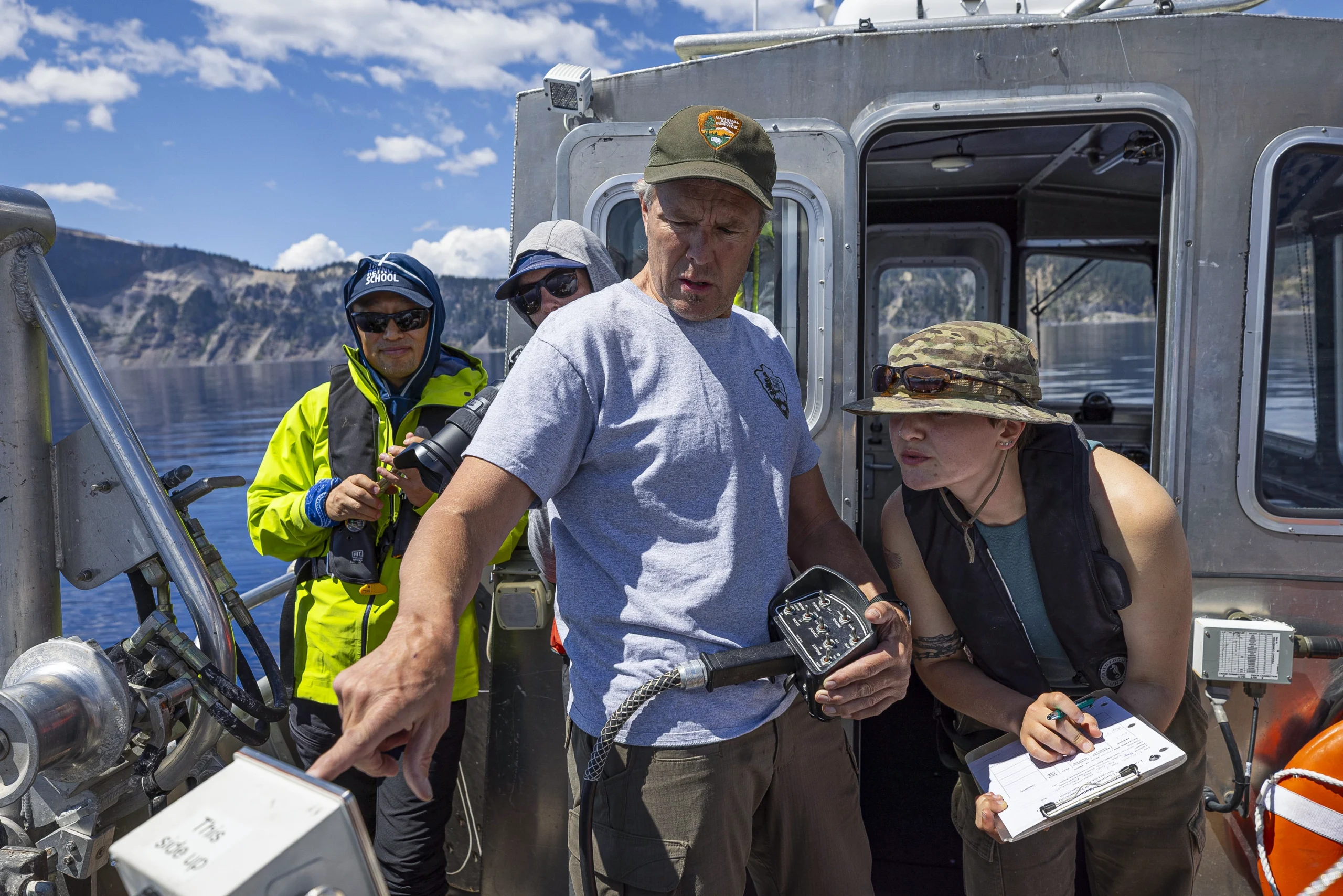

To measure water clarity, Scott Girdner and Taryn Weller, biologists at Crater Lake National Park, lower a black-and-white Secchi disc (right) and record the depth at which it vanishes. Crater Lake’s first Secchi reading was taken in 1886.
Katie Falkenberg for Quanta Magazine
“People are just amazed and wowed at the optical blue that you see from pure water itself,” said Sudeep Chandra, a limnologist at the University of Nevada, Reno, who collaborates with Girdner. “That blueness is the reflection of the hydrogen and oxygen hanging out together without any material in it.”
Since 2010, however, Girdner and his colleagues have noticed an unexpected change in the Secchi data: Despite the day’s slightly cloudy reading, Crater Lake’s clear water is getting even clearer.
This might sound like a good thing. After all, the lake’s remarkable, glasslike transparency and brilliant hue are major draws for the half-million tourists who visit every year. But it might also indicate that something is going wrong with the lake’s physics, chemistry and ecology, and it could be a harbinger of changes to lakes across the world in the age of climate change.
As the planet warms, summers are growing longer and winter nights aren’t getting as cold as they used to. As a result, the surfaces of many deep, temperate lakes are warming even faster than the air. This shift to the energy flux of the top layer of water can set in motion a series of physical changes that add up to a breakdown of lake mixing — a fundamental process that acts like a heartbeat for deep, temperate lakes that don’t freeze in winter. Lake mixing is driven by physical properties such as wind, air temperature, water temperature and salinity, and on seasonal or annual cycles it circulates water between the surface and the depths. When mixing stops, oxygen and nutrients don’t get distributed throughout the water column, which can kill fish, trigger unsightly and dangerous algal blooms and invite invasive species to take over.
“Many people visit Crater Lake because of its pristine water quality and blueness,” said Sudeep Chandra of the University of Nevada, Reno. “What happens if that changes?”
Katie Falkenberg for Quanta Magazine
From Italy to New Zealand and beyond, scientists have been alarmed to observe reduced lake mixing. In 2021, Chandra and his colleagues published evidence in Nature of greater stratification in the water column over time — an indicator of weaker mixing — in 84% of 189 temperate lakes for which they could find sufficiently long and robust datasets. Some lakes had stopped mixing altogether. “While each system is unique, the endgame is generally the same: a lack of mixing for these large, deep lakes,” Chandra said.
Of the world’s millions of lakes, Crater Lake is one of very few with a monitoring program that stretches back more than 40 years. Scientists are now beginning to realize how crucial those datasets are for unraveling lake physics and how climate change is altering it. “Because local weather can be extremely variable from year to year, it takes many years to capture the range in conditions and measure ‘normal,’” Girdner said. “Hence the advantage of long-term datasets.”
Crater Lake is therefore at the center of the first efforts by researchers, including Girdner and Chandra, to compare lake systems to get to the bottom of their breakdown, so they can prepare for the future and perhaps even ward off the most extreme impacts.
“Historically, people have studied lakes one at a time,” said Stephanie Hampton, director of the Tahoe Environmental Research Center at the University of California, Davis. In light of how quickly things are changing, that siloed approach no longer works, she said. “We need to learn from each other and synthesize these data to understand what’s happening globally.”
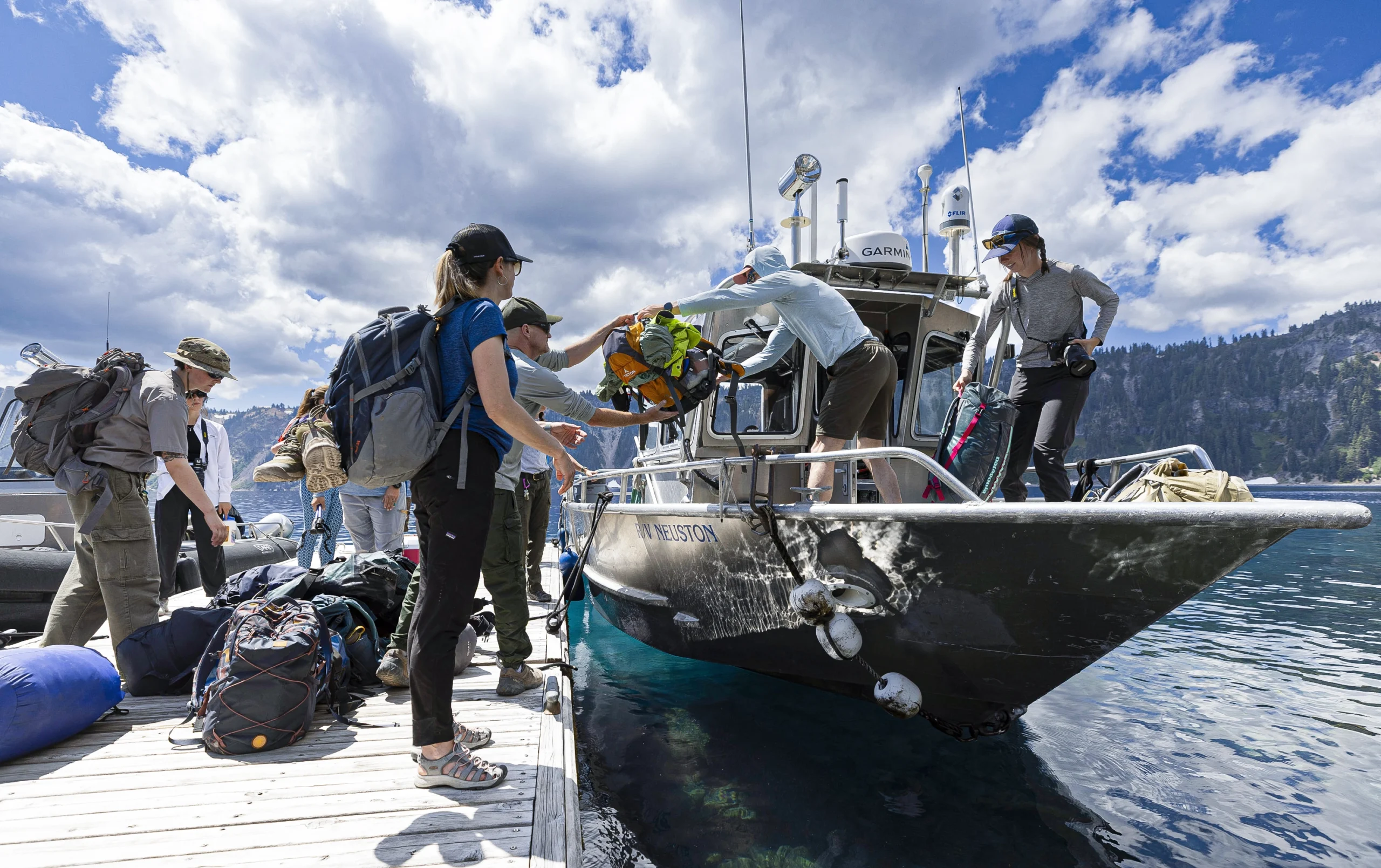
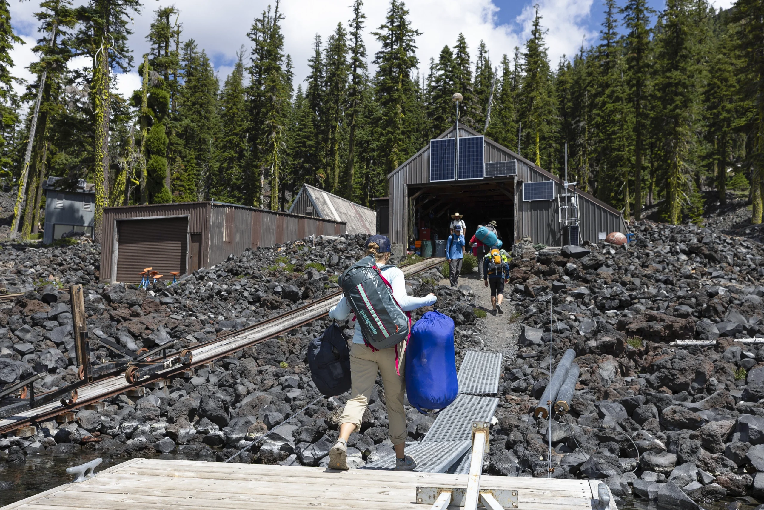
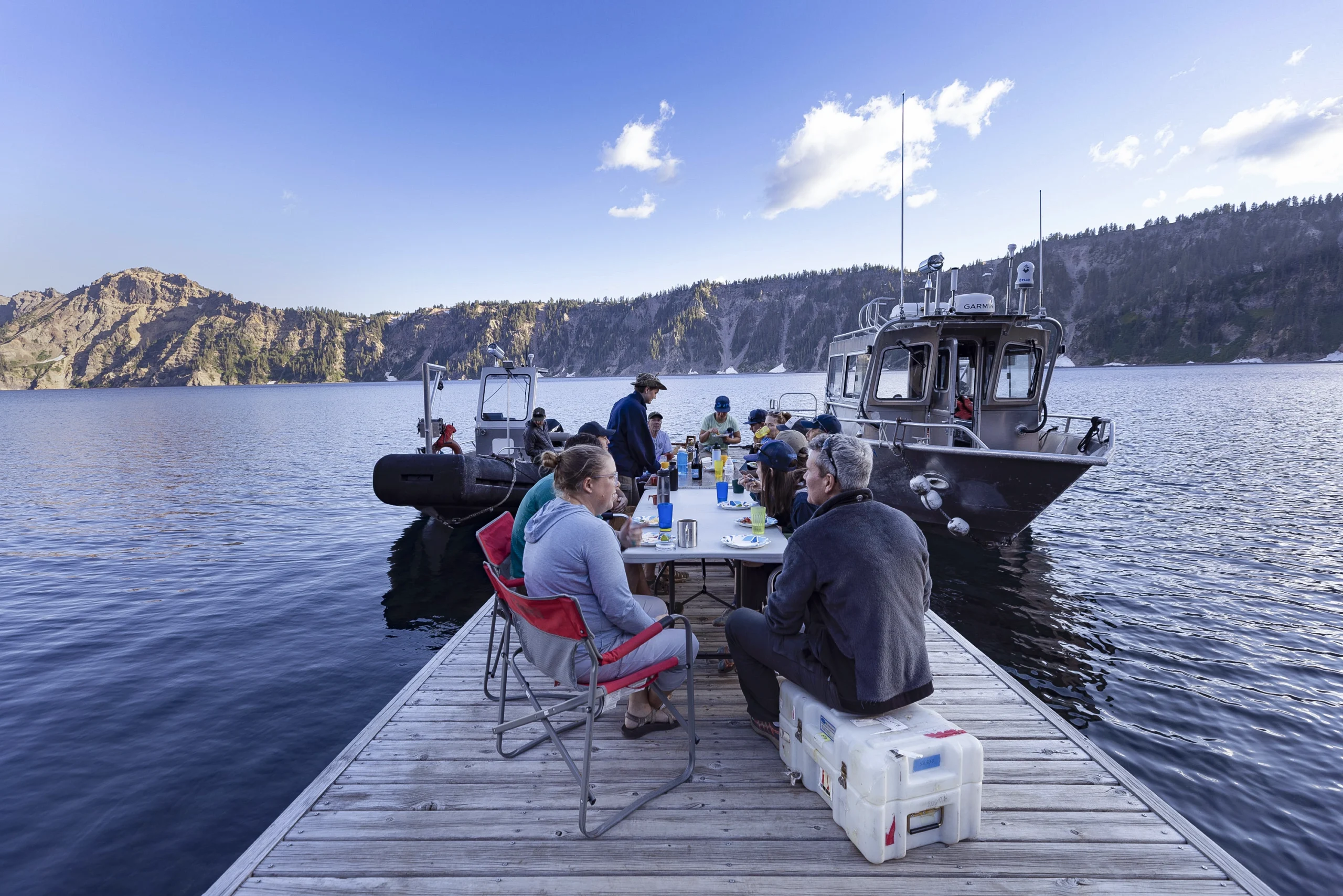
In July 2025, researchers journeyed to the remote research station on Wizard Island, the volcanic cinder cone near the western shore of Crater Lake. On the boat dock they ate their meals (including fresh-caught invasive crayfish) and slept out under the stars.
Katie Falkenberg for Quanta Magazine
Canary in the Lake
In 2006, five deep lakes in northern Italy — Iseo, Como, Garda, Maggiore and Lugano — stopped fully mixing. At first, scientists didn’t think much of it. They had been monitoring the lakes since the 1980s and 1990s, and it was normal for a few years to go by without complete mixing. But as time passed and the clear waters remained stubbornly in place, they began to fear that the pause might be permanent.
Their fears seem to have been borne out. “It’s been 20 years that we haven’t observed any full mixing from the top to the bottom,” said Barbara Leoni, a freshwater ecologist at the University of Milan-Bicocca. “I don’t know that it will be possible to return to the past behavior.”
Lake mixing is a function of the fact that water has different densities at different temperatures. In deep temperate lakes, this creates stratification in the water column: Lighter, warmer water floats on top, and colder, denser water sinks below. Any number of factors can influence mixing, but it is primarily driven by seasonal temperature changes, wind and waves.
Because these features vary from place to place and from lake to lake, mixing does not follow a single formula. In many lakes, complete mixing occurs once or twice a year, usually in spring and fall. In very large lakes, mixing might happen in the shallow upper waters on annual or seasonal cycles, while full mixing to the deepest bottom layer may occur only every few years. By studying different lakes, scientists are hoping to find shared rules.
Italy’s deep northern lakes previously achieved complete mixing on an approximately seven-year cycle. During the summer, the lake water would maintain distinct layers as surface waters warmed and remained light and in place. As surface temperatures dropped in autumn and winter, the layers would become closer in temperature; with a push from the wind, the lake would begin to mix. This redistributed heat, oxygen, nutrients and toxins throughout the water column.
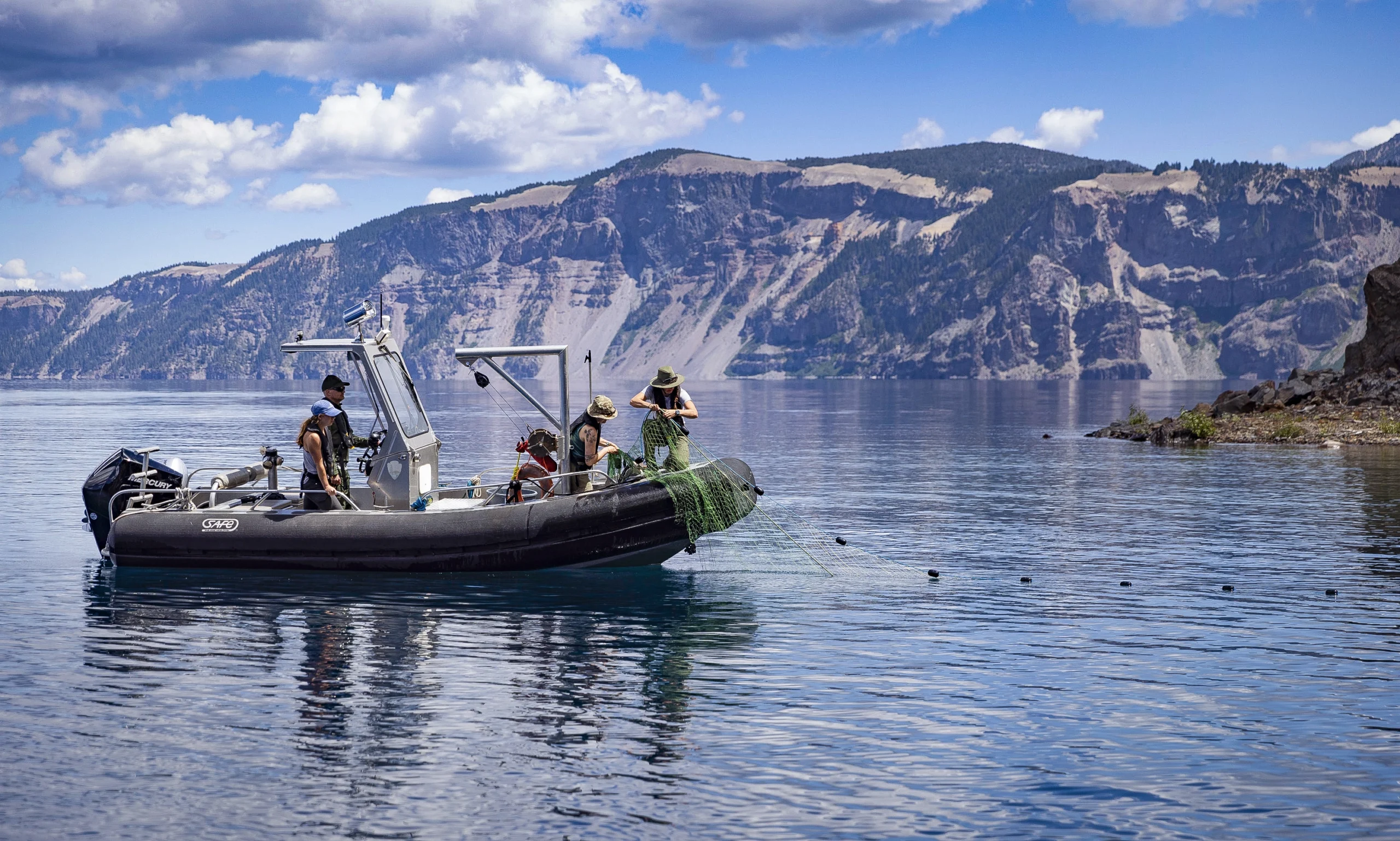
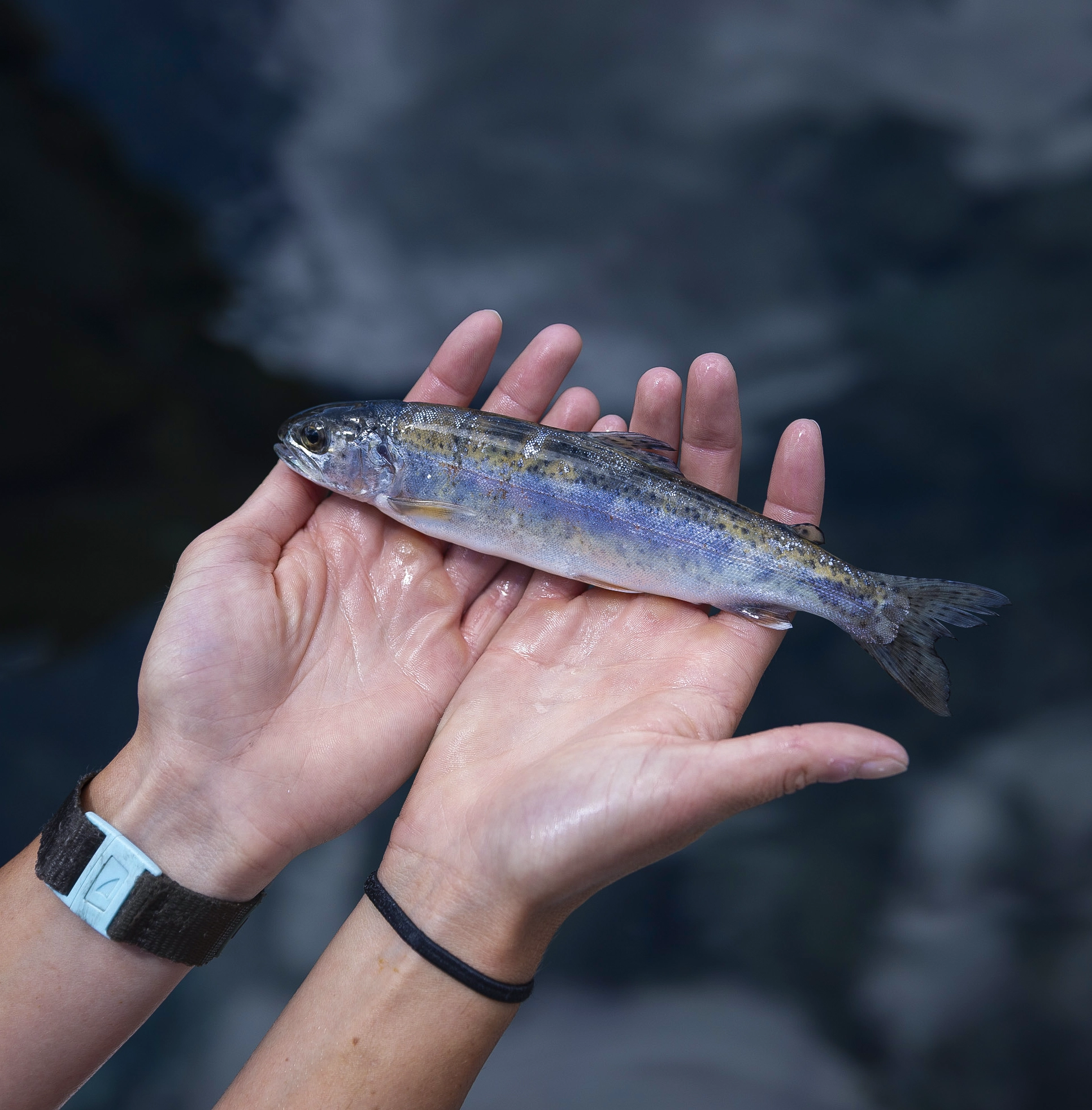
Researchers pull in a gill net to assess fish populations.
Katie Falkenberg for Quanta Magazine
That’s not how the Italian lakes work anymore, however. Now, the surface waters fail to get cool enough to sink and trigger mixing. As a result, oxygen is disappearing from the bottom of the stratified lake. It has already been depleted entirely in Lake Iseo. “We have 150 meters of water without oxygen,” Leoni said. This kills off oxygen-breathing life at depth and transforms the biological community. “In lakes where the deep waters have been oxygen-free for a long time, only bacteria survive,” she said.
The hearts of Italy’s deep lakes have stopped and are no longer circulating nutrients; they show what can happen when lakes stop mixing. Crater Lake offers a different opportunity: to study how, exactly, warming temperatures can break the fundamental physics of a lake.
Mixing Mix-Up
On summer days, viewed from the rim of the ancient caldera that holds it, Crater Lake is a perfect mirror reflecting the procession of clouds and colors of the sky above. But beneath that glassy surface, dynamic processes are underway.
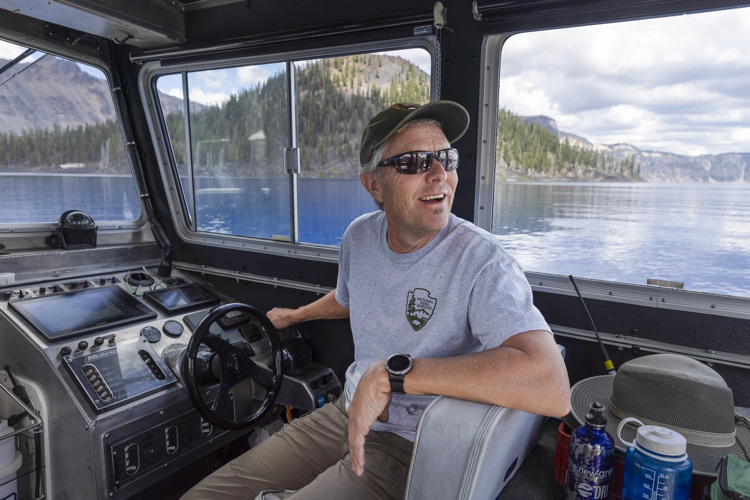
Scott Girdner, a freshwater biologist at Crater Lake National Park, has run the lake’s long-term monitoring program since 1995. He will retire at the end of 2025.
Katie Falkenberg for Quanta Magazine
Compared to many other large lakes around the world, Crater Lake is close to pristine. It is surrounded by wilderness and protected as a national park. The air above it is mostly wind blowing off the Pacific Ocean, with few polluting cities or industries nearby. The lake lacks any rivers or streams emptying into it that could bring in pollution from elsewhere; it is filled by rain and melting snow. In July, Girdner and Chandra filled two large water coolers with lake water — enough to keep the team of around 13 visiting scientists, students and National Park employees, plus a journalist and photographer, hydrated overnight. The lake’s water tasted as pure as bottled water, and it maintained a natural, refreshing temperature under the blazing summer sun.
The water purity does more than provide good drinking: It makes Crater Lake an ideal system for studying climate impacts. Without the confounding factors of agriculture, sewage, parking lot runoff and water withdrawals that tend to affect other lakes, Girdner said, “it’s easier to see the influence of climate change.”
Girdner started working at Crater Lake in 1995 and has overseen the long-term monitoring program ever since. He often tells his staff that it’s not enough to just record change; they must also understand its drivers and its implications for the lake’s physics, chemistry and biology. To that end, every night at 8 p.m., a tube-shaped profiler instrument crawls along an anchored metal cable from a depth of 585 meters to Crater Lake’s surface and back down again. On this round trip, it tests twice a second for water conductivity, temperature, oxygen and salinity. Other sensors use light to measure chlorophyll fluorescence and phytoplankton particle density.
That dataset and others tell the story of Crater Lake’s health across time. Like virtually all lakes around the world, it’s getting warmer: Average surface water temperatures have increased by 3 degrees Celsius since 1965. In summer, nighttime air temperatures are increasing faster than daytime ones; the coldest summer nights are not as cold as they used to be. And there are more summer nights: Crater Lake has gained 33 additional days of summer weather per year over the past 60 years, as spring arrives earlier and earlier.
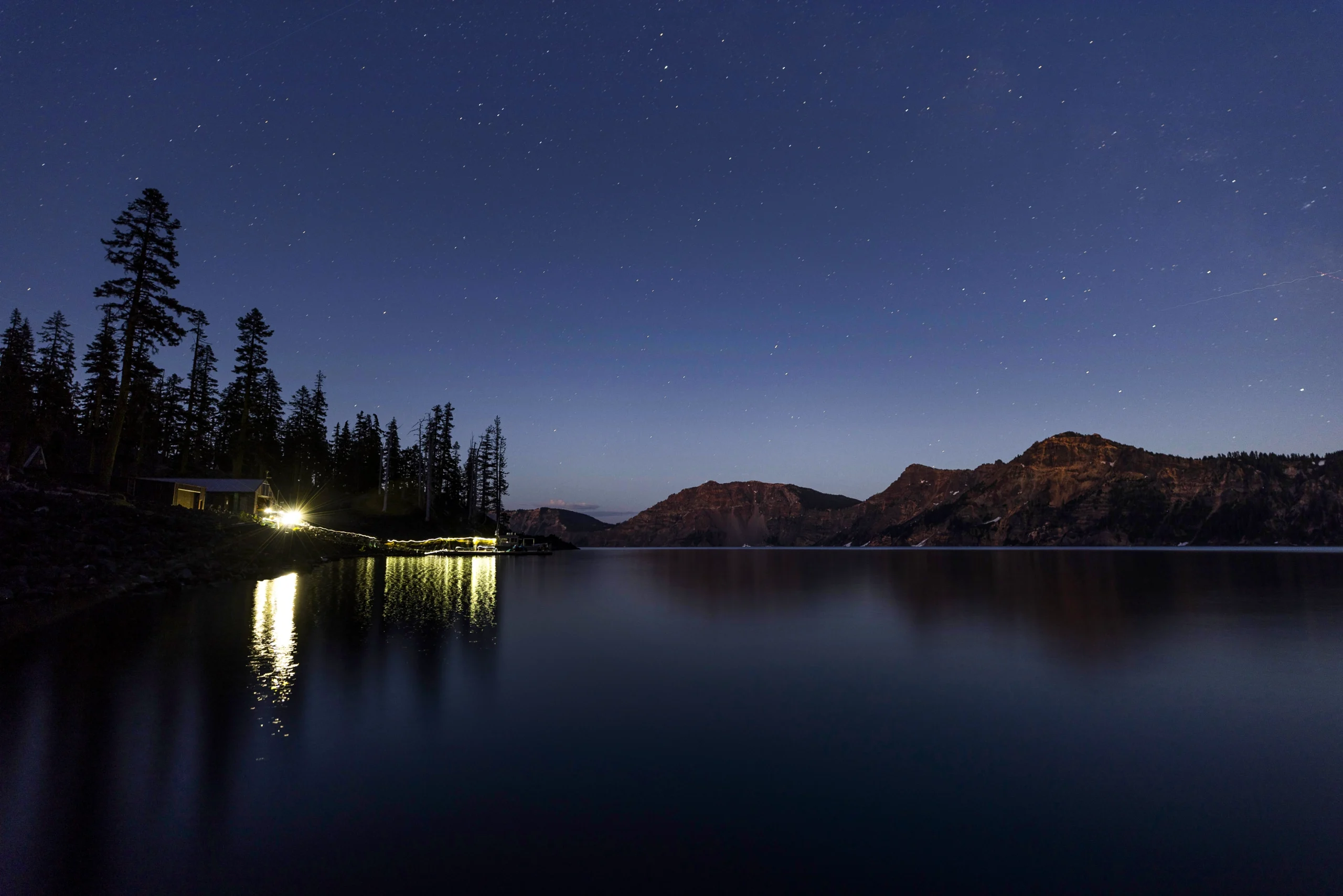
The remoteness that makes Crater Lake ideal for isolating climate change impacts also makes it a top location for stargazing. On average 98.6% of potentially visible stars can be seen at the site, according to NPS data.
Katie Falkenberg for Quanta Magazine
In the past, when summer nights grew cold, the lake released the day’s accumulated heat, causing surface water to become denser and sink. This phenomenon drives the shallow mixing that occurs in summer. As nights have warmed, however, this process has weakened, and mixing has slowed.
Counterintuitively, as the layer of surface water has become warmer, it has also become thinner. “In the summer, there is half as much warm water floating on the surface now, on average, than there was in 1971,” Girdner said. This creates a sharper density difference with the cold water below, which in turn increases the amount of wind energy required to break through and mix the layers.
“I think about it like a vinaigrette,” said Kevin Rose, a freshwater ecologist at Rensselaer Polytechnic Institute in New York who collaborates with Girdner and Chandra. “There’s resistance to mixing.”
So what does all of this have to do with the fact that the lake is getting clearer? That’s where biology comes in. In Crater Lake’s warm surface water lives a community of phytoplankton. A thinner warm surface layer means less habitat, so there are fewer phytoplankton, which means fewer particles in the water to scatter light. This boosts the water’s clarity overall and the depth to which light can penetrate.
Crater Lake’s winter processes, which mix the lake all the way to the bottom, are undergoing their own profound changes. These transformations involve the weakening of a phenomenon called reverse stratification, in which a layer of very cold water, cooled by frigid winter air, forms on top of a slightly warmer layer that is around 4 degrees Celsius, the temperature at which water is heaviest. (At temperatures below that, water molecules begin to organize into lighter ice crystals.) When strong wind pushes the extra-cold surface water horizontally, as it approaches the lake’s edge some of it is forced down. If it is pushed down far enough, the increased pressure causes it to become denser than the 4-degree water layer. It then sinks to the bottom in a matter of hours, creating a mixing effect.


Mark Belan/Quanta Magazine
Historically, reverse stratification occurred during 80% to 90% of Crater Lake winters. As winters warm, it is becoming less common. “Crater Lake is sitting on a knife edge where it’s already really close to not being able to form reverse stratification,” Girdner said.
This does not bode well for the lake’s future mixing. When Girdner’s colleagues used his data to simulate what might happen under a range of climate scenarios, the model predicted that reverse stratification will become rare within about 50 years. If the process stops entirely, Crater Lake will no longer mix to the bottom at all. Over decades, an oxygen dead zone will begin to form — similar to the ones in the northern Italian lakes. This risks significant ecological impacts, as well as a buildup of toxic compounds that could billow up to the surface if the lake does mix again.
Crater Lake is just starting on the path toward such dramatic changes. Another iconic lake a few hundred miles away suggests what might happen next.
A Trickle-Down Effect
Lake Tahoe, the second-deepest lake in the United States, on the California-Nevada border, once rivaled Crater Lake in its clarity. In the 19th century, rocks glistened through its crystal-clear water. Then, rapid population growth in the 1950s polluted the water, causing algae to start growing offshore. In recent years, those algae have advanced into shallower waters. Secchi disc readings show that, since 1967, clarity in Lake Tahoe has been reduced by nearly 40 feet. The lake’s formerly rich blue hue is now diminished in some places.
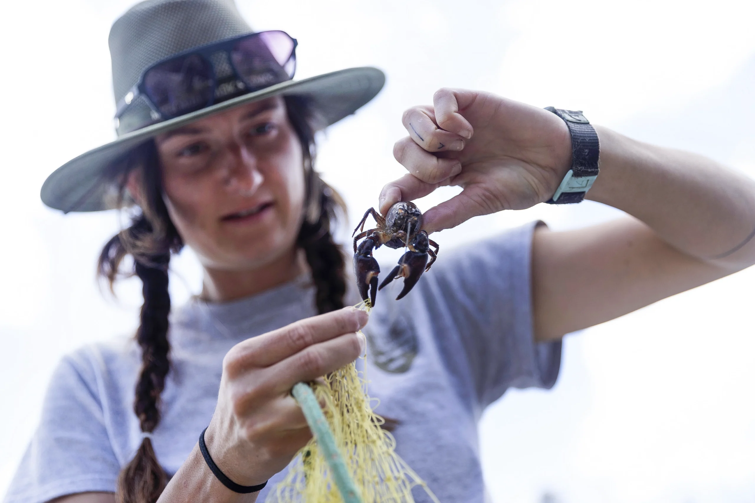
Jaden Bellamy, a biological science technician at Crater Lake National Park, monitors the lake’s wildlife, including invasive crayfish (left) and rainbow trout (right).
Katie Falkenberg for Quanta Magazine
These trends will likely continue as climate change advances, said Michael Dettinger, a hydroclimatologist at Scripps Institution of Oceanography at the University of California, San Diego. As Lake Tahoe’s mixing breaks down and summer waters get warmer and linger longer, phytoplankton enjoy an enhanced growing season and cloud the water. Over the next century, more intense and frequent storms are projected to increase water inflows, likely bringing “enormous spikes” of sediments and nutrients into the lake, Dettinger said. Smoke from wildfires also deposits particles, which can change the light structure and nutrient composition of the lake.
Such events can affect a lake’s trajectory for years, Chandra said. When combined with altered lake mixing, they create a vicious ecological cycle.
Algae blooms are a product of these and other disruptions. In addition to killing fish, the accumulation of oxygen-poor, nutrient-rich water that builds up in a stratified lake — especially one loaded with extra nutrients from runoff and wildfires — can leak to the shoreline, triggering nearshore algae growth that forms a green bathtub ring surrounding a clear center. “That’s one of the working hypotheses for what we think is happening in Lake Tahoe,” Chandra said.
Crater Lake suffered its first bloom of shoreline algae in 2021. “It looked like someone took a massive bright green highlighter along the shore,” Girdner said. Because lake tours were closed due to the Covid-19 pandemic that summer, there was no public outcry. Had the bloom occurred during a normal summer — like July 2025, when tourists crowded the lake in passenger boats to marvel at the seemingly bottomless blue abyss around them — the situation might have made national headlines.

Researchers process crayfish and fish to monitor the lake’s health. “You can measure vital signs of a human being and get some idea if something seems to be wrong or if things are changing,” Girdner said. “We do similar things in the lake.”
Katie Falkenberg for Quanta Magazine
When the green ring appeared, Girdner and his colleagues felt overwhelmed. At first they had no idea what could be driving the sudden growth. Then they noticed a telling detail: The greenest places were those with the highest numbers of invasive crayfish. When crayfish move into an area, the population of insect larvae and other aquatic invertebrates that graze on algae declines by about 95%. “They just hammer the insects,” Girdner said. In experiments, Girdner and his colleagues found that about seven times more algae grow in areas with crayfish compared to those without.
Yet Girdner suspected there was more than crayfish at work. Those invasive predators had regrettably been introduced to the lake in 1915, but in the intervening century, no other major algae blooms had occurred. He and his colleagues found, instead, that record-breaking water temperatures during the exceptionally hot summer of 2021 had fueled the algae growth. Crayfish had just given it a boost.
Milder winters have let the crayfish population grow and spread to new areas of the lake, further disrupting ecosystems. The Mazama newt (or Crater Lake newt), a subspecies found nowhere else in the world, has virtually disappeared. In addition to competing for the same invertebrate prey, the crayfish also capture newts in their pincers and devour the hapless amphibians alive.
Similar climate-driven invasive species patterns have been seen in other lakes. These cascading impacts exemplify the fact that lake conditions are inherently and intimately tied to climate, Chandra said. “We cannot divorce the biological composition and interactions within a lake from the climatic conditions within the landscape.”
The sun rises over the volcanic heap of Wizard Island on July 23, 2025.
Katie Falkenberg for Quanta Magazine
Teasing out the interactions between climate, lake mixing and ecology at Crater Lake will give research teams around the globe a blueprint for what to expect as the world continues to warm, and could be key to averting worst-case scenarios.
An Uncertain Future
Last year, Chandra, Leoni and other researchers were sitting in a cafe near Lake Iseo, comparing notes about climate change at their lakes, when the cafe owner interrupted. “Why do we even need to know this?” Chandra recalled him asking. “There’s not much we can do about it, so why even care?”
It’s a sentiment that Chandra often encounters. He harbors hope, however, that some impacts to lakes can be slowed or avoided. While individuals cannot stop the juggernaut of climate change, he said, local interventions could make a difference. Those strategies would be context-dependent, but they could include working to balance a lake’s nutrients, controlling invasive species, cleaning up pollution, or restoring the forests and wetlands surrounding lakes.
Collaborations between different groups of scientists could enhance such interventions, said Veronica Nava, a postdoctoral researcher in freshwater ecology at the University of Milan-Bicocca. “If one lake has already experienced what you’re observing, you can come up with better strategies,” she said.
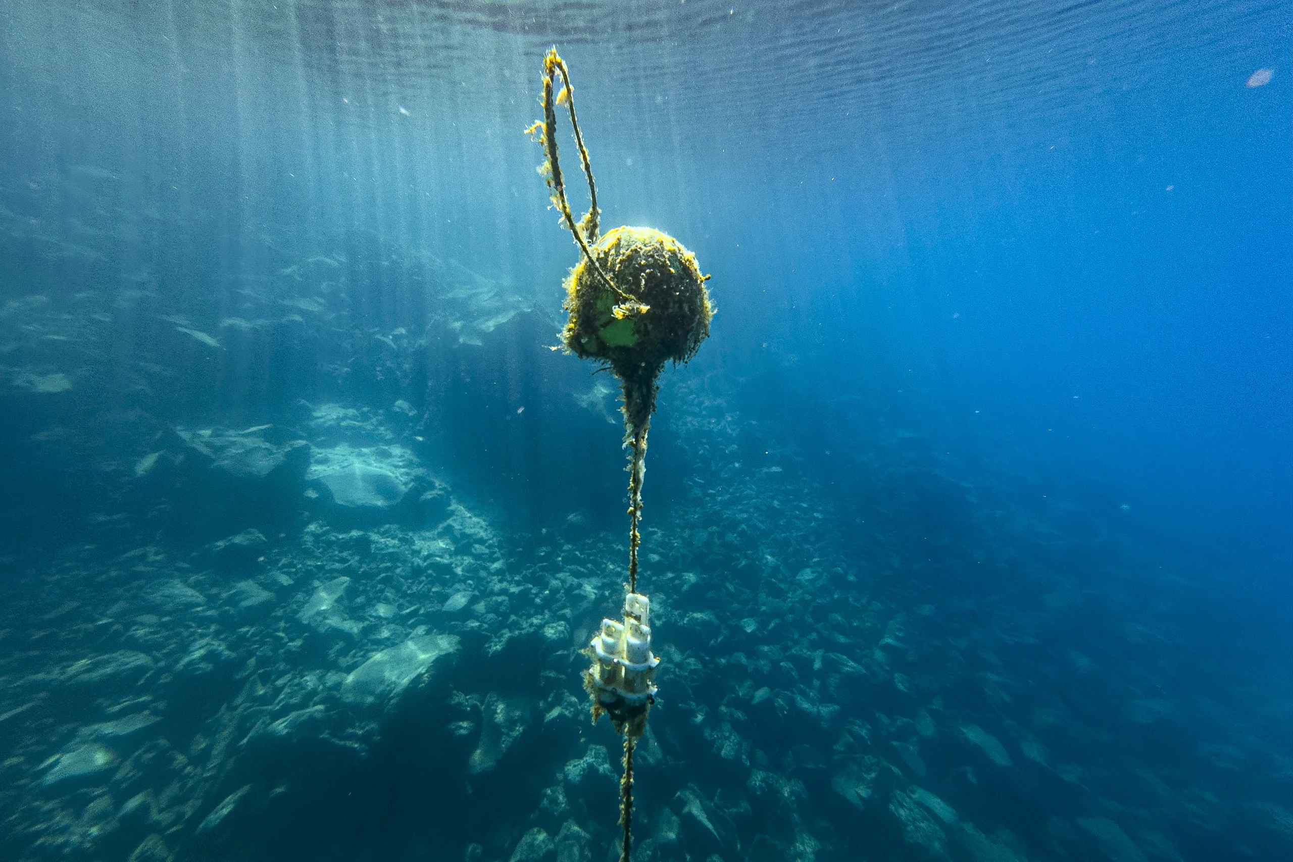
A buoy is attached to a mooring sensor, which measures optical chlorophyll fluorescence and turbidity. The NPS has six of these sensors around Crater Lake.
Katie Falkenberg for Quanta Magazine
Teamwork “is really where freshwater science is moving,” Hampton said. But such efforts are in their early days, as researchers have only started to think about comparing large lake ecosystems over the last few years. Now threats to U.S. research are rattling their newfound collaboration. “The cuts to research funding are going to hit large collaborations pretty hard,” Hampton said.
The future of even Crater Lake’s exemplary scientific program is in jeopardy. After spending nearly his entire career at the lake, Girdner is retiring at the end of the year. The federal government has frozen hiring for the National Park Service, so his position will remain unfilled indefinitely. It’s unrealistic, he said, to expect his colleagues to continue the same research output on their own. “We’re going to have to pare down what we’re doing,” he said.
Until then, they’re focused on what they can do: adding another year’s data to Crater Lake’s history. After a busy day, Girdner steered the vessel back to the dock at Wizard Island, a volcanic cinder cone that juts out of Crater Lake like a pointy hat. In the cluttered boathouse, decades of signatures and sketches coated the wooden walls, bearing witness to the students and scientists who had made some contribution to a better understanding of the lake. Chandra boiled a few invasive crayfish until they were delectably tender, and the group ate them with dabs of hot sauce. They passed around a few bottles of prosecco to toast Girdner’s retirement.
As the sun dipped low, the exhausted scientists unrolled sleeping bags on the dock. Girdner had spent countless nights on the island (more than his ex-wife had liked, he admitted). This would be one of his last. The sky’s soft gradient of pink, orange and gold slowly darkened, and the Milky Way twinkled into view. Voices faded, while bats skimmed the water’s still surface. The lake’s future was uncertain. But the urgency of protecting its natural splendor could not have been clearer.