
Silver Shadows: The Quiet Conquest of São Paulo’s Waters by an Amazon Invader
A specimen of P. squamosissimus caught in the Chavantes reservoir (São Paulo state): originally from the North region, it may be competing with and contributing to a decline in the population of native species. However, it has become a key fishing resource in much of the country. Credit: Edmir Daniel Carvalho/CAUNESPIn São Paulo, Brazil, the Silver croaker, an invasive species, has become the predominant fish in the Jaguari reservoir and surrounding rivers, significantly diminishing the diversity of native fish species. Despite its economic importance, controlling its population poses significant ecological and legal challenges.The Silver croaker (Plagioscion squamosissimus), also known as corvina or pescada-branca in Portuguese, is native to the Amazon and is likely responsible for the significant decline in the diversity of native species in the Jaguari Reservoir, Jaguari River, and Rio do Peixe. These water bodies are integral components of the Cantareira Water Production System and the Paraíba do Sul Basin, located in São Paulo state, Brazil.As a top predator in the food network, the invader has negatively affected local biodiversity by bringing about detrimental changes to its taxonomic, functional and phylogenetic structure, according to a study published in Biological Invasions by researchers at São Paulo State University (UNESP). They analyzed fish monitoring data collected by power utility CESP (Companhia Energética de São Paulo), which has recorded the presence of the species in the reservoir since 2001. The data analyzed is for a period ending in 2016. In no more than ten years, P. squamosissimus has become the most abundant fish species in the reservoir.Research and Monitoring Efforts“Although this predator is widely distributed in hydroelectric dam reservoirs throughout Brazil, its potential effects on native species had never been studied before. Our analysis highlights considerable losses to fish species diversity in the region,” said Aymar Orlandi Neto, first author of the article. Conducted at the Ilha Solteira School of Engineering (FEIS-UNESP), the study was part of his PhD research at the Botucatu Institute of Biosciences (IBB-UNESP) with a scholarship from FAPESP. Some of the results were obtained while he was doing research at the University of Valencia in Spain with a scholarship from FAPESP.CESP does this monitoring of fauna to comply with environmental licensing rules for operation of the dam and power plant enforced by IBAMA, the main federal environmental agency. Every four months its technicians install nets at predetermined locations in the reservoir (between Jacareí and São José dos Campos) and on the Peixe and Jaguari, identify the species caught, and estimate their abundance.Effects on Native Predators“We analyzed 15 years of monitoring data and found the abundance of native predators, particularly the Thin dogfish (Oligosarcus hepsetus), to have declined significantly as P. squamosissimus preyed on smaller fish and became more abundant,” said Igor Paiva Ramos last author of the article and a professor at FEIS-UNESP.However, it is not possible to tell from the available data whether the decline of O. hepsetus was due to indirect competition, since both this species and the invader may prey on the same fish. Another possibility is that P. squamosissimus, which can reach 80 cm, preyed on O. hepsetus, which is much smaller (30 cm as an adult). The former typically inhabits standing water bodies, such as lakes, and has thrived in the reservoir, whereas O. hepsetus, the native predator, prefers running water.Economic ImpactInvader species are a global problem and occur in environments of all kinds, on land and in water. In Brazil, the annual damage caused by non-native animals, plants, and microorganisms has been estimated at BRL 15 billion (now about USD 2.9 billion).The figure is from the Thematic Report on Invasive Exotic Species, Biodiversity and Ecosystem Services, launched in March by the Brazilian Platform on Biodiversity and Ecosystem Services (BPBES), which is supported by FAPESP via its Research Program on Biodiversity Characterization, Conservation, Restoration and Sustainable Use (BIOTA-FAPESP).In the article on the UNESP study, the researchers stress that other introduced species appear in the records for the Jaguari reservoir, including the Peacock bass (Cichla spp.), also native to the Amazon, and Oreochromis niloticus and Coptodon rendalli, both of which are tilapias and originally from Africa, but their numbers are very small, reinforcing the conclusion that native diversity has dwindled due to P. squamosissimus.The diversity loss observed by the authors applies to all three dimensions considered when this type of impact is assessed – taxonomic, functional and phylogenetic. Species richness losses during the period analyzed were noted, alongside substitution of many rare specialist species by a few generalists, and significant differences were found in species composition and abundance in the local fish community, with entire evolutionary groups disappearing.Management ChallengesThere are no simple solutions to the problem. The species is seen as a key fishing resource for both subsistence and sport. Eradicating it could cause social problems. “The species has become very common throughout Brazil. It replaces native species and now plays a very important social role in local economies,” Ramos said.Nevertheless, he proposed measures similar to those taken in other countries to deal with invader species. One such measure would be to permit hunting of this species throughout the year without size limits or a ban during the reproductive period, with the aim of eradicating it or at least reducing its abundance.However, federal and state laws restrict fishing not just of native species, which is quite right, but also of invasive species to some extent. “This ends up perpetuating the species that are harmful to local fauna,” Orlandi Neto said.Ramos pointed out that eradication of invaders does not necessarily lead to a return of the natives. “We don’t know whether another invader will take the place of P. squamosissimus if it’s removed. The environment has been modified to such an extent that it may no longer be suitable for former inhabitants,” he said.Reference: “Long-term impact of an invasive predator on the diversity of fish assemblages in a neotropical reservoir” by Aymar Orlandi Neto, Danilo Caneppele, Hugo Marques, João Henrique Pinheiro Dias, Juan Antonio Balbuena, Claudio de Oliveira and Igor Paiva Ramos, 14 February 2024, Biological Invasions.DOI: 10.1007/s10530-023-03243-9
In São Paulo, Brazil, the Silver croaker, an invasive species, has become the predominant fish in the Jaguari reservoir and surrounding rivers, significantly diminishing the...
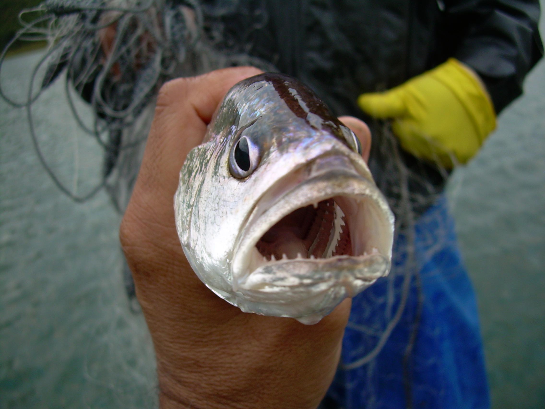
A specimen of P. squamosissimus caught in the Chavantes reservoir (São Paulo state): originally from the North region, it may be competing with and contributing to a decline in the population of native species. However, it has become a key fishing resource in much of the country. Credit: Edmir Daniel Carvalho/CAUNESP
In São Paulo, Brazil, the Silver croaker, an invasive species, has become the predominant fish in the Jaguari reservoir and surrounding rivers, significantly diminishing the diversity of native fish species. Despite its economic importance, controlling its population poses significant ecological and legal challenges.
The Silver croaker (Plagioscion squamosissimus), also known as corvina or pescada-branca in Portuguese, is native to the Amazon and is likely responsible for the significant decline in the diversity of native species in the Jaguari Reservoir, Jaguari River, and Rio do Peixe. These water bodies are integral components of the Cantareira Water Production System and the Paraíba do Sul Basin, located in São Paulo state, Brazil.
As a top predator in the food network, the invader has negatively affected local biodiversity by bringing about detrimental changes to its taxonomic, functional and phylogenetic structure, according to a study published in Biological Invasions by researchers at São Paulo State University (UNESP).
They analyzed fish monitoring data collected by power utility CESP (Companhia Energética de São Paulo), which has recorded the presence of the species in the reservoir since 2001. The data analyzed is for a period ending in 2016. In no more than ten years, P. squamosissimus has become the most abundant fish species in the reservoir.
Research and Monitoring Efforts
“Although this predator is widely distributed in hydroelectric dam reservoirs throughout Brazil, its potential effects on native species had never been studied before. Our analysis highlights considerable losses to fish species diversity in the region,” said Aymar Orlandi Neto, first author of the article. Conducted at the Ilha Solteira School of Engineering (FEIS-UNESP), the study was part of his PhD research at the Botucatu Institute of Biosciences (IBB-UNESP) with a scholarship from FAPESP. Some of the results were obtained while he was doing research at the University of Valencia in Spain with a scholarship from FAPESP.
CESP does this monitoring of fauna to comply with environmental licensing rules for operation of the dam and power plant enforced by IBAMA, the main federal environmental agency. Every four months its technicians install nets at predetermined locations in the reservoir (between Jacareí and São José dos Campos) and on the Peixe and Jaguari, identify the species caught, and estimate their abundance.
Effects on Native Predators
“We analyzed 15 years of monitoring data and found the abundance of native predators, particularly the Thin dogfish (Oligosarcus hepsetus), to have declined significantly as P. squamosissimus preyed on smaller fish and became more abundant,” said Igor Paiva Ramos last author of the article and a professor at FEIS-UNESP.
However, it is not possible to tell from the available data whether the decline of O. hepsetus was due to indirect competition, since both this species and the invader may prey on the same fish. Another possibility is that P. squamosissimus, which can reach 80 cm, preyed on O. hepsetus, which is much smaller (30 cm as an adult). The former typically inhabits standing water bodies, such as lakes, and has thrived in the reservoir, whereas O. hepsetus, the native predator, prefers running water.
Economic Impact
Invader species are a global problem and occur in environments of all kinds, on land and in water. In Brazil, the annual damage caused by non-native animals, plants, and microorganisms has been estimated at BRL 15 billion (now about USD 2.9 billion).
The figure is from the Thematic Report on Invasive Exotic Species, Biodiversity and Ecosystem Services, launched in March by the Brazilian Platform on Biodiversity and Ecosystem Services (BPBES), which is supported by FAPESP via its Research Program on Biodiversity Characterization, Conservation, Restoration and Sustainable Use (BIOTA-FAPESP).
In the article on the UNESP study, the researchers stress that other introduced species appear in the records for the Jaguari reservoir, including the Peacock bass (Cichla spp.), also native to the Amazon, and Oreochromis niloticus and Coptodon rendalli, both of which are tilapias and originally from Africa, but their numbers are very small, reinforcing the conclusion that native diversity has dwindled due to P. squamosissimus.
The diversity loss observed by the authors applies to all three dimensions considered when this type of impact is assessed – taxonomic, functional and phylogenetic. Species richness losses during the period analyzed were noted, alongside substitution of many rare specialist species by a few generalists, and significant differences were found in species composition and abundance in the local fish community, with entire evolutionary groups disappearing.
Management Challenges
There are no simple solutions to the problem. The species is seen as a key fishing resource for both subsistence and sport. Eradicating it could cause social problems. “The species has become very common throughout Brazil. It replaces native species and now plays a very important social role in local economies,” Ramos said.
Nevertheless, he proposed measures similar to those taken in other countries to deal with invader species. One such measure would be to permit hunting of this species throughout the year without size limits or a ban during the reproductive period, with the aim of eradicating it or at least reducing its abundance.
However, federal and state laws restrict fishing not just of native species, which is quite right, but also of invasive species to some extent. “This ends up perpetuating the species that are harmful to local fauna,” Orlandi Neto said.
Ramos pointed out that eradication of invaders does not necessarily lead to a return of the natives. “We don’t know whether another invader will take the place of P. squamosissimus if it’s removed. The environment has been modified to such an extent that it may no longer be suitable for former inhabitants,” he said.
Reference: “Long-term impact of an invasive predator on the diversity of fish assemblages in a neotropical reservoir” by Aymar Orlandi Neto, Danilo Caneppele, Hugo Marques, João Henrique Pinheiro Dias, Juan Antonio Balbuena, Claudio de Oliveira and Igor Paiva Ramos, 14 February 2024, Biological Invasions.
DOI: 10.1007/s10530-023-03243-9